

The U.S. Fish and Wildlife Service is seeking public review and comment on the Draft Programmatic Compatibility Determination for Rights‑of‑Way and Rights to Access for Temporary Disturbances and Minor Impacts on Conservation Easements in the Mountain‑Prairie Region. This draft document evaluates the compatibility of proposed activities that may cause temporary, minor disturbances while supporting necessary public infrastructure needs across conservation easements in the Mountain-Prairie Region. The draft Compatibility Determination will be available for a 30‑day public comment period from April 1 to May 1, 2026. Comments, questions, concerns, or a request for a hard copy can be sent to: MountainPrairieNWRS@fws.gov.

We work closely with the state to update water conditions across the Rainwater Basin. Updates will be coming toward the end of August. Please visit the Nebraska Game and Parks Commission waterfowl page for more information.
Visit Us
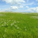
Rainwater Basin Wetland Management District's 61 Waterfowl Production Areas provide numerous recreational opportunities such as birding, wildlife observation, hunting, and photography to thousands of visitors every year.
Location and Contact Information
About Us
The indigenous homelands of the Pawnee (Pâri) and the Jiwere, this geographic area, called the Rainwater Basin, is a complex of wetlands scattered throughout a 21-county area. The wetlands are shallow basins that provide resting and feeding areas for millions on birds during spring and fall migration.
What We Do
The management goal of the U.S. Fish and Wildlife Service within the Rainwater Basin is to restore, as much as possible, the natural hydrologic and ecological function of wetlands for the benefit of migratory birds and resident wildlife. For the grasslands, our goal is to reestablish and maintain diverse native grassland communities.

Our Species
Rainwater Basin is known internationally for its significance to migratory birds. Millions of birds funnel into the Basin on their northward migration each spring. The more impressive species, by their sheer numbers, are white-fronted geese, mallards, pintails, snow geese, and sandhill cranes.