States
Alabama, Connecticut, Delaware, Florida, Georgia, Louisiana, Maine, Maryland, Massachusetts, Michigan, Minnesota, Mississippi, New Hampshire, New Jersey, New York, North Carolina, Ohio, Puerto Rico, Rhode Island, South Carolina, Texas, Virgin Islands, Virginia, WisconsinOverview
The maps referenced on this page are comprehensively revised draft maps prepared by the U.S. Fish and Wildlife Service (Service) for public review (referred to as “proposed maps”) or Congressional consideration (referred to as “final recommended maps”). These draft maps make progress toward fulfilling a mandate in the Coastal Barrier Resources Reauthorization Act (Pub. L. 109-226) to modernize all John H. Chafee Coastal Barrier Resources System John H. Chafee Coastal Barrier Resources System
Learn more about the John H. Chafee Coastal Barrier Resources System, which was established under the Coastal Barrier Resources Act in 1982.
Learn more about John H. Chafee Coastal Barrier Resources System (CBRS) maps and make recommendations to Congress for the expansion of the CBRS. These draft maps will only become effective if enacted into law by Congress.
Please note that this page includes small projects only; information about our larger scale projects (such as the Hurricane Sandy Remapping Project) is available on separate project pages which can be found here.
Access materials relating to previous mapping projects that have been made effective through legislation enacted by Congress.
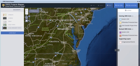
CBRS Projects Mapper (Draft Revised Units)
- Use this mapper to view DRAFT revised CBRS units.
- *Note: Data last modified November 25, 2024. The revised units in this mapper are not currently effective.
Alabama
The Service has transmitted to Congress a final recommended map for five CBRS units (Mobile Point Unit Q01P, Pelican Island Unit Q01A/Q01AP, and Alligator Lake Unit AL-05/AL-05P) located in Baldwin and Mobile Counties, Alabama.
The final recommended map for these CBRS units, dated April 10, 2015, was prepared following a 60-day public review period of a proposed map in 2011. The final recommended map, a summary of the public comments received and the Service's responses to those comments, and a summary of the final recommended changes to the units are below. An archive of the earlier proposed map and associated documents is also available below.
Final Recommended Map dated April 10, 2015 and Related Information
- Summaries of Final Recommended Changes:
- Summary of Public Comments Received and Service Responses and Recommendations
- Final Recommended Map for Units Q01P, Q01A/Q01AP, AL-05/AL-05P
- Final Recommended Map for Units Q01P, Q01A/Q01AP, AL-05/AL-05P with Existing Boundaries*
Archive of Proposed Map dated September 22, 2009 and Related Information
- Federal Register Notice announcing availability of proposed maps and request for comments (September 12, 2011)
- Summaries of Proposed Changes:
- Proposed Map for Units Q01P, Q01A/Q01AP, AL-05P
- Proposed Map for Units Q01P, Q01A/Q01AP, AL-05P with Existing Boundaries*
*The existing CBRS boundaries depicted on this map have been superseded by a new map dated January 11, 2016. The final recommended boundary on this map is correct. Please see the latest CBRS map for this area for a current depiction of the existing boundaries.


