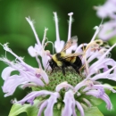
The Minnesota-Wisconsin U.S. Fish and Wildlife (USFWS) Ecological Services Field Office developed a High Potential Zone (HPZ) model using ArcGIS software that considers the likelihood of rusty patched bumble bee (Bombus affinis) movement based on the National Land Cover Database (NLCD, https://www.usgs.gov/centers/eros/science/national-land-cover-database). This model allows us to assess the likelihood of bumble bee distribution from the locations of known records based on the manner in which various land cover types may affect bumble bee movement and behavior. Land cover types are grouped as having strong, moderate, weak, or no limits on B. affinis movement based on the best available information for this species or similar bumble bee (Bombus) species. This methodology was based on a similar model created to examine movement of the yellow-faced bumble bee (B. vosnesenskii) (i.e., Jha and Kremen 2013, entire). The polygons generated from the B. affinis HPZ model suggest areas with the highest potential for the species to be present based on typical bumble bee foraging distances, estimated dispersal distances, and ability of bumble bees to move through various land cover types. This model does not attempt to identify or quantify suitable B. affinis habitat.
Publication date
Facility
Program
Species
FWS Focus


