Photo By/Credit
Karen Ceballos/USFWSDate Shot/Created
11/19/2024Media Usage Rights/License
Public Domain
Image
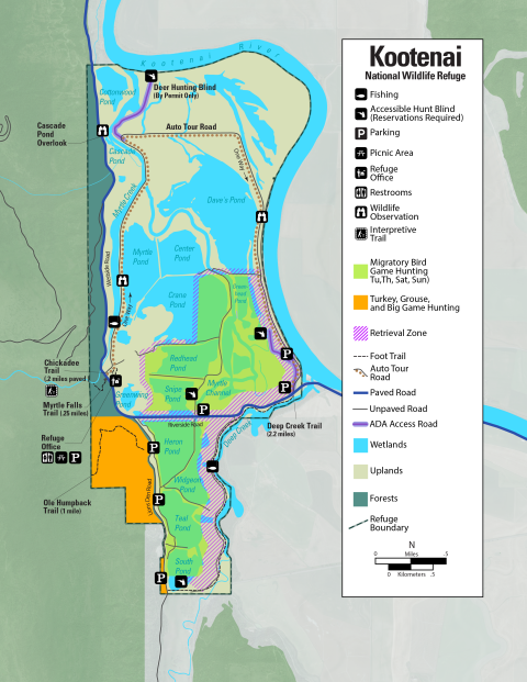
Kootenai National Wildlife Refuge hunting map showing areas for migratory bird game hunting and turkey, grouse and big game hunting. The refuge is covered in labeled bodies of water and its southern border lies along the Kootenai River. There is an Auto Tour route that goes in a loop around the interior of the Refuge. The Migratory Bird Game hunting area is located on the southern part of the Refuge, along Redhead pond, snipe pond, myrtle channel, Greenhead pond, Heron pond, Widgeon pond, Teal pond and south pond. The map identifies accessible hunt blinds, parking, picnic areas, restrooms, interpretive trails, the refuge office and ADA access roads. The Turkey, grouse and big game hunting is located on the south west corner of the refuge, to the west of Lions Den Road. For more information, please contact 208-267-3888 or visit www.fws.gov/refuge/kootenai/.
Recreational Activity
