Photo By/Credit
Karen Ceballos/USFWSDate Shot/Created
11/20/2024Media Usage Rights/License
Public Domain
Image
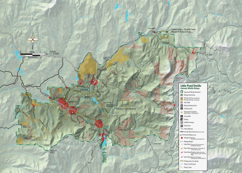
Little Pend Oreille National Wildlife Refuge hunting map shows the approved refuge boundaries, and identifies private land and Washington Department of Natural Resource land within the approved refuge boundary. The Refuge is located 6 miles east of Coville. The refuge is covered in labeled bodies of water, including McDowell Lake and Bayley Lake within the Refuge boundaries. The map identifies dispersed campsites, refuge entrances, refuge headquarters, restrooms, hiking trails, fishing locations, wildlife viewing areas, established campgrounds, county roads and gate roads with their respective open seasons. There is a Refuge Auto Tour route that goes in a loop around the interior of the Refuge. For more information, please contact (509) 684-8384 or visit www.fws.gov/refuge/little-pend-oreille.
