Photo By/Credit
University of Maryland in coordination with the/USFWS
Date Shot/Created
05/27/2022Media Usage Rights/License
Public Domain
Image
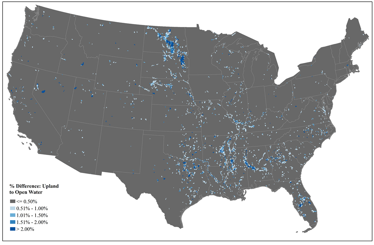
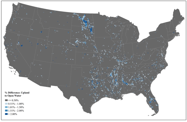
Upland to Open Water Difference Product for HUC12 watersheds in the contiguous U.S. Watersheds with ≤0.5% of upland to open water difference, calculated by area, are displayed in gray, while those that have greater than 2% difference are displayed in dark blue. Patterns are largely controlled by the age of National Wetlands Inventory (NWI) data and land cover trends, including the addition or increase in pond and lake area via natural and anthropogenic forces. Areas exhibiting the greatest amount of difference (i.e., change) include the Prairie Pothole Region and the southeastern U.S. Geographies with the greatest levels of difference could be prioritized for NWI updates.