States
North CarolinaEcosystem
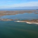
WetlandPocosin Lakes National Wildlife Refuge encompasses approximately 110,106 acres of Washington, Hyde, and Tyrrell Counties in eastern North Carolina. In addition to more than 8,300 acres of managed waterfowl habitat, the refuge also has more than 101,600 acres of pocosin peatlands. Pocosin (a Native American term meaning “swamp on a hill”) wetlands occur on peat domes and are at slightly higher elevations than the surrounding lands. On most of the refuge, rainfall is the only manner through which water is added to the system.
Previous owners of the lands that now make up the refuge installed ditches and canals to farm and harvest timber in the area. About a third of the Refuge, more than 44,000 acres, was heavily ditched and drained. The extensive ditch system in this unique habitat drained and artificially dried out the peat soil, degrading habitat and making the areas more susceptible to catastrophic wildfire.
Since the refuge’s establishment – early 1960s for the Pungo Unit and early 1990s for the rest of Pocosin Lakes NWR--the Service has installed a resilient system of infrastructure that counteracts the impacts of ditching and draining by retaining and conserving rainwater to provide high quality wintering waterfowl habitat and restore more natural pocosin wetland hydrology and habitat. The refuge uses this infrastructure, primarily dikes and water control structures, to stop the artificial drainage of water from the soil and restore the pocosin wetlands.
Healthy pocosins are foundational to healthy ecological and human communities. The restoration is benefiting wildlife and people by maintaining high quality wetland habitat. When pocosins function as nature intended, seasonal water level fluctuations moisten the soils, protecting against catastrophic fire, easing the impacts of storm flows, and repelling the ever increasing threat of salt water intrusion in surrounding lands.
Extreme weather events, including periods of significant rainfall and periods of drought, can have significant impacts on refuge and adjacent lands, infrastructure, and water drainage. In anticipation of these impacts, strategic planning calls for a more comprehensive approach of supportive and complementary strategies on and off-refuge aiming to broaden the understanding of water movement on the landscape, identify barriers to water movement or other issues across the landscape, and identify opportunities for incentive programs and other possible solutions for addressing barriers and issues identified.
Working with a diverse set of partners, the Service has restored over 37,000 acres of unique peatland habitat that is important to wildlife and people alike. This is one of the largest wetland restoration projects of its kind in the country.
With the vast majority of restoration efforts now complete, the refuge is shifting to a focus on science-driven adaptive management to reconnect and invigorate a healthy pocosin landscape and to continue to provide high quality habitat for thousands of wintering swans, geese, and ducks as well as many other migratory birds and wildlife species.
The Service produced a video explaining the restoration and thanking our partners on this project.
Stakeholder Engagement
The refuge held a series of virtual meetings in July 2020 to share a summary of the draft Water Management Plan and invite public comment on the plan. Links to recordings of these meetings can be found below; a transcript of the presentation is also available in the Documents below.
July 17, 2020 Virtual Information Session
July 9, 2020 Virtual Information Session
In addition, the refuge held another virtual meeting on August 17, 2021, providing updates on a number of projects related to Hydrology Restoration on the refuge.

