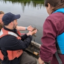
Invasive species, primarily plants, are found throughout the refuge. Invasive plants outcompete native vegetation, creating monotypic stands of undesirable vegetation that have little to no wildlife value. Refuge biologists go into these invasive habitats with iPad tablets to map the locations of the plants. Located invasives are marked in a grid map system with each grid being 50 by 50 meters squared. After the invasives have been mapped, biologists will apply water-based herbicides to eradicate the plants. While the spraying is being conducted, a biologist with the iPad tablet will enter the data into a database identifying the areas that were herbicidally treated and the areas that were not. With this monitoring technique, we can track how effective the herbicide treatments were and we are more efficient in data processing.
At Edwin B. Forsythe NWR, the areas where intensive invasive species invasive species
An invasive species is any plant or animal that has spread or been introduced into a new area where they are, or could, cause harm to the environment, economy, or human, animal, or plant health. Their unwelcome presence can destroy ecosystems and cost millions of dollars.
Learn more about invasive species monitoring is conducted are located at the Holgate Unit (the southern end of Long Beach Island), and the former Forked River Game Farm in Lacey Township. At Holgate, Asiatic Sand-Sedge (Carex kobomugi) is an aggressive and dense invasive which has the high potential of colonizing prime piping plover nesting areas, reducing the likelihood of piping plovers to nest at that location. At the Forked River Game Farm, the invasive Bradford Pear (Pyrus calleryana) tree is an aggressive invasive that outcompetes native trees and shrubs in grassland and early successional habitats. Without the monitoring and removal of theses invasive plants, habitats will become single-species invasive habitats, providing little resource value to native wildlife populations.
Wilderness areas are places untamed by humans. The Wilderness Act of 1964 allows Congress to designate wilderness areas for protection to ensure that America's pristine wild lands will not disappear. Wilderness areas can be part of national wildlife refuges, national parks, national forests or public lands managed by the Bureau of Land Management.
Learn more about wilderness area .


