Monitoring

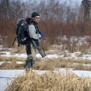
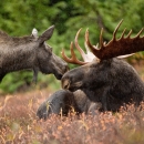
Kanuti National Wildlife Refuge, the Alaska Department of Fish and Game, and the Bureau of Land Management (BLM), cooperatively conduct semi-annual, aerial moose population surveys of Kanuti Refuge and surrounding State and BLM lands in small, two-seat aircraft.  We survey in early winter so that we can differentiate between cows and bulls (which haven’t dropped their antlers yet).  The survey information is used to inform moose hunting regulations.

Facilities

Kanuti Flats aerial view with spotted bodies of water.
The Athabascan name for Kanuti is "Kk'toonootne" which translates to "well traveled river by both man and animals." Kanuti Refuge is about the size of the state of Delaware and straddles the Arctic Circle, with approximately a third of the Refuge above the Circle and two-thirds below it. Kanuti...

Contact

Programs

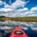
A bright blue sky obstructed by fluffy white clouds reflected off of a stream shot from inside a kayak
The U.S. Fish and Wildlife Service manages an unparalleled network of public lands and waters called the National Wildlife Refuge System. With more than 570 refuges spanning the country, this system protects iconic species and provides some of the best wildlife viewing opportunities on Earth.

Species