States
Illinois, Indiana, Iowa, Michigan, Minnesota, Missouri, Ohio, WisconsinIn 2023, the Data Management Branch was established at the Midwest Fisheries Center to serve the data management needs of the various program areas within the Fish and Aquatic Conservation Program in Region 3. In doing so, we are better able to meet our conservation mission by improving open access to and utility of the data we collect for the public and our conservation and management partners.
What is Data Management?
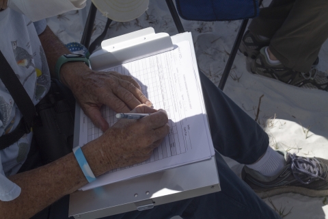
Simply put, data management is properly planning, documenting, and caring for our data and the information we derive from the data we collect. A Service biologist might spend hours in the field collecting habitat or species information, but without proper data management, the data might not be usable (or even discoverable) by researchers, policymakers, or even our own colleagues.
Good data management enables data to be located and shared, which increases efficiency by reducing redundancy. Managing data improves conservation outcomes and supports the mission of the Service. The data we collect, maintain, and analyze represent and embody the trust resources we seek to conserve and manage. Making decisions based on reliable and accessible data improves our conservation outcomes, as well as the Service’s scientific credibility.
Vision for Data in Region 3 Fish and Aquatic Conservation Program
The Midwest Fisheries Center Data Branch envisions a Region 3 Fish and Aquatic Conservation Program that has adopted a data centric culture to implement transparent, evidenced-based conservation decisions by ensuring quality data is produced and managed using the U.S. Fish and Wildlife Service’s data life cycle and FAIR (Findable, Accessible, Interoperable, and Reusable) data principles.
Findable:
Data collected and the associated background information surrounding them (i.e., metadata) can be easily located by others. Datasets will have established keywords and unique identifiers that can be used by others to search for and locate data.
Accessible:
Collected data can be easily accessed by others by centralizing data and informing those interested in the data how it can be accessed.
Interoperable:
Because the data we collect today will likely be integrated with other datasets in the future, the data (and metadata) we collect will be described and maintained in such a way that that both humans and computers can exchange, interpret, and integrate each other’s data into a new dataset.
Reusable:
Data will be optimized for use and reuse. To prepare data for use, data and metadata collected will include how and why the data was collected, how it’s formatted, where it’s located, how to access it, etc.

