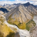
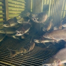
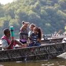
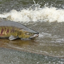
This project enumerates Yukon River fall Chum Salmon in the upper portion of the Yukon River drainage. The Teedriinjik River (formerly designated as the Chandalar but recently reverted back to its Gwich'in names) is a major river system in Interior Alaska. Its salmon stocks support vital subsistence and commercial fisheries in the Yukon River drainage, and are an important resource for local people and the Yukon Flats National Wildlife Refuge. The fall chum salmon population in this river is recognized as the largest stock of fall chum salmon in the Yukon River drainage. The Northern Alaska (formerly Fairbanks) Fish and Wildlife Field Office has counted the fall chum salmon returning to the Chandalar from 1987 to 1990 and from 1994 to the present. The purpose of the project is to provide fisheries managers and users of the resource an accurate estimate of the number of fall chum salmon returning to spawn. This estimate, and other information collected during the project, is used to help managers prepare outlooks of future fall chum salmon runs, and to evaluate fall chum salmon management decisions and strategies. While Chinook salmon are present in the Teedriinjik River earlier in the season, the sonar project begins after nearly all of the Chinook salmon have migrated upriver, and only provides estimates of fall chum salmon. From 2004 to 2006 The USFWS evaluated the possibility of counting Chinook salmon. However, numerous chum salmon are present at the same time, and we cannot reliably tell the difference between the two species with the sonar at this time. Additionally, attempts to use test fishing similar to that used with other sonar projects to apportion the sonar counts to species, proved unreliable in the Teedriinjik River.
The project begins in early August and continues until the end of September. Two DIDSONs, (sonar units) one on each river bank, are installed. Targets are placed on the river bottom, and drifted through the beams to help position and aim the sonars. The sonars run continuously for 24 hours per day. All data is saved to files on a computer, then manually reviewed to produce fish counts. Counts from the sonar are reported back to the field office and are available to managers daily

