


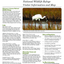
Visit Us
National wildlife refuges offer us all a chance to unplug from the stresses of daily life and reconnect with our natural surroundings. Aransas National Wildlife Refuge is a bit "off the beaten path," but it's well worth the visit!
Driving Directions
From the South: Follow Highway 35N to the FM 774 exit. Turn right on FM 774 and go approximately 6 miles, winding through the farm fields. Turn right again on FM 2040. Drive another 6 miles to the Refuge entrance.
From the North: Travel south on Hwy 35 to Tivoli. Continue past Tivoli approximately 1 mile to the FM 239 exit (on your left). Follow FM 239 to Austwell. Upon entering Austwell, FM 239 turns into FM 774 at the curve. Continue on FM 774. Follow 774 and take a right at the stop sign. At the end of the street, take a right again. As you exit Austwell, drive ½ mile to the FM 2040 intersection. Turn left on FM 2040 and drive 6 miles to the Refuge entance.
The GPS coordinates for the refuge’s main entrance are: 28.313449,-96.804022.
Fees
General Entrance Fees
*Note that the refuge only accepts cash at this time.
18 years and under, entrance is free
$3 – one adult in a vehicle
$5 – two or more adults in a vehicle
$25 – commercial vehicle (van or bus) with up to 20 people
$50 – commercial vehicle with 21 or more people
Refuge entrance is free with the following passes, which are available for purchase when the Visitor Contact Station is open.
Aransas Annual Pass – $15
Entrance to Aransas National Wildlife Refuge. Good for one year from the date purchased.
Federal Duck Stamp – $25
Permits entrance to all National Wildlife Refuges that charge an entrance fee. Valid July 1 – June 30.
Annual Pass – $80
Annual entrance pass to National Parks, National Wildlife Refuges, National Forests, and Bureau of Land Management sites that charge entrance fees. Available to the general public.
Annual Pass for Active Military – Free
Annual entrance pass to National Parks, National Wildlife Refuges, National Forests, and Bureau of Land Management sites that charge entrance fees. Available to active military members with proper identification.
Senior Pass – $20 annual, $80 lifetime
Lifetime entrance pass to National Parks, National Wildlife Refuges, National Forests, and Bureau of Land Management sites that charge entrance fees. Available to citizens or permanent residents of the U.S. that are age 62 or older.
Access Pass – No fee
Lifetime entrance pass to National Parks, National Wildlife Refuges, National Forests, and Bureau of Land Management sites that charge entrance fees. No fee. Available to citizens of the U.S. that are legally blind or permanently disabled. Must show proof of permanent disability to purchase.
"Every Kid in a Park" 4th Grade Annual Pass - Free
The Every Kid in a Park pass was created so that every fourth grader and their family can experience the nation's wildlife, history, and resources for free.
Restrooms
Public restrooms are available at the Visitor Center, picnic area, and observation tower.
What to Do
If you have 15-minutes:
- Visit the Alligator Viewing Area or Rail Trail Bridge for a quick look around.
If you have one hour:
- Take a drive down to the Observation Tower and enjoy the beautiful scenery along the way.
If you have half a day or more:
- Take time to walk along one or more of our scenic nature trails, enjoy a picnic at our picnic area, fish on the pier, and drive the one-way section of our auto tour loop.
Activities
Come out and enjoy Aransas National Wildlife Refuge!
Trails
Trail Map and Guide
A trail map and guide is available online or hard copies can be obtained at the refuge.
Rail Trail
Length: 0.5 miles
Waterbirds, from rails to bitterns, lurk in the reeds lining Tomas Slough. This grassy trail parallels the long, narrow wetland that is home to alligators as well.
Alligator Viewing Area
Length: <0.1 mile
Take a short walk up the ramp and look for alligators in Tomas Slough, one of the few freshwater resources on the refuge. On sunny days, you may see an alligator basking on the bank. Listen for frogs and birds calling and look for fish swimming in the water.
Heron Flats Trail
Length: 1.4 miles
Freshwater sloughs, shell ridges, oak forests, and tidal flats make this trail quite diverse. You’ll find two observation platforms equipped with spotting scopes. If you’re lucky, you might see a whooping crane family feeding in the marshy salt flats. Watch, too, for herons, egrets, roseate spoonbills, pelicans, and other wildlife.
* Please note that this trail will not make a loop.
Songbird Loop
Length: 0.1 mile
Listen to a spring songbird serenade as you wander this short woodland loop.
Oak Sanctuary
Length: 0.1 mile
Walk this short trail towards San Antonio Bay and experience the mystery of a 500- year old oak tree. What might you find hiding in its branches, or seeking its shade? The oak is covered in mustang grapevine.
Dagger Point Trail (CURRENTLY CLOSED)
Length: 1 mile
Hike a winding trail through an oak/ red bay forest. One of the few hills on the refuge offers an excellent vista.
Jones Lake
Length: <0.1 mile
A very short, paved walkway leads to a platform overlooking the lake, another potential alligator hangout. The water in this lake comes entirely from rainfall.
Big Tree Trail
Length: 0.7 mile
Encounter some of the refuge’s largest live oak trees along this woodland loop.
Observation Towers and Boardwalk
In addition to crane watching, the two observation towers (20’ and 40’) offer a panoramic view of San Antonio Bay and Mustang Lake. Both towers are fully accessible with gently sloping ramps. Follow the boardwalk across the tidal flat to the Big Tree Observation Deck. Look for animal tracks in the mud.
Fishing Pier
Open Season: Year-round
Length: 100 feet
Open all year, the fishing pier offers excellent opportunities to catch red fish and sea trout. It is also a fun place to watch for dolphins in the bay and sting rays swimming below. Here is where you might also see brown pelicans, terns, and water birds that change with the tide.
Auto Tour Loop
Length: 16 miles
The paved tour loop provides a leisurely ride through Texas savannah, what Texas must have looked like a hundred years ago. The scenic ride becomes a one-way at the Observation Tower. Along the way you might get to see deer, hawks, javelina, bobcat, and an occasional rattlesnake crossing the road.
Related Documents
Other Facilities in the Complex
The Matagorda Island Unit of the Aransas National Wildlife Refuge is part of a long chain of barrier islands that extend down the Texas coastline. This rugged landscape is host or home to many amazing wildlife species including whooping cranes, Kemp’s ridley sea turtles, reddish egrets, alligators and coyotes.
In 1994, a revised Memorandum of Agreement with the State of Texas combined the Matagorda Island National Wildlife Refuge and Texas Parks and Wildlife Department’s State Natural Area. It is managed as a unit of the Aransas National Wildlife Refuge and is an overlay to a state Wildlife Management Area.
Our partner, Texas Parks and Wildlife, has the lead responsibility for public use management on the island. Aransas National Wildlife Refuge has the lead responsibility for the wildlife and habitat management. It was established to support the national migratory bird management program and to conserve endangered species.
Rules and Policies
To ensure your safety and protect wildlife and habitat, please follow these rules and regulations. If you have questions, please contact the Refuge at 361-349-1181. To report a wildlife violation, please call 1-844-FWS-TIPS (844-397-8477).
General Rules
- Daily registration and fee payment are required.
- Closing times are strictly enforced; gates will close and lock 30 minutes after sunset.
- Drones, remote controlled aircraft, and unmanned aerial vehicles are prohibited.
- There are no trash receptacles on the refuge. You must remove all trash when you leave - "pack it in, pack it out." Littering is prohibited.
Alcohol
- Use of alcoholic beverages and controlled substances is prohibited.
- Entering or remaining on the refuge while under the influence of alcohol or controlled substances is prohibited.
Pets
- Pets must be kept on a short leash (4-6 feet) and under owner control at all times.
- Do not allow pets to drink or enter water; alligators and venomous snakes are present.
Animal, Plant, and Artifact Collection and Disturbance
- Feeding or disturbing wildlife is strictly prohibited.
- Collection of plants, animals, or artifacts is strictly prohibited; no metal detectors allowed.
Trails and Roadways
- Speed limit is 25 miles per hour. Watch for wildlife on roadways.
- Only street legal vehicles are allowed, and only on designated refuge roads.
- No ATVs, UTVs, or dirt bikes are allowed on or off refuge roads.
- Bicycling is permitted on the auto tour loop only; no bikes are allowed on trails, boardwalks, observation platforms, or towers.
- For your own safety, hiking is allowed only on trails and walkways.
Camping
- Public camping is not allowed anywhere on the refuge. Scouts and other environmental groups can call 361-349-1181 for more information about camping at the Youth Environmental Training Area.
Picnicking
- Picnicking is allowed at designated picnic areas. Only propane grills are allowed.
- All trash must be removed as there are no trash receptacles. "Pack it in, pack it out."
- No charcoal, open fires, or fireworks are allowed on the refuge.
Fishing
- Fishing is permitted in designated areas and during designated times only.
Hunting and Firearms
- Hunting is permitted only in designated areas and during designated seasons; permit required.
- Persons possessing, transporting, or carrying firearms on National Wildlife Refuges must comply with all provisions of state and local law. Persons may only use (discharge) firearms in accordance with refuge regulations.
Locations


From the South: Follow Highway 35N to the FM 774 exit. Turn right on FM 774 and go approximately 6 miles, winding through the farm fields. Turn right again on FM 2040. Drive another 6 miles to the Refuge gate. Go to the Visitor Contact Station to register.
From the North: Travel south on Hwy 35 to Tivoli. Continue past Tivoli approximately 1 mile to the FM 239 exit (on your left). Follow FM 239 to Austwell. Upon entering Austwell, FM 239 turns into FM 774 at the curve. Continue on FM 774. Follow 774 and take a right at the stop sign. At the end of the street, take a right again. As you exit Austwell, drive ½ mile to the FM 2040 intersection. Turn left on FM 2040 and drive 6 miles to the Refuge gate. Go to the Visitor Contact Station to register.
The GPS coordinates for the refuge’s main entrance are: 28.313449,-96.804022.