Visit Us
National Wildlife Refuges are places where wildlife comes first, and where people can experience the beauty of the natural world in a truly wild place. Although people are welcome, activities are regulated and monitored to ensure that impacts are minimal to the plants and animals that call the refuge “home”. Scroll down to learn more about ways to Visit Us to have a memorable and safe experience at Malheur National Wildlife Refuge.
- Malheur Lake
- Visitor Center, Nature Store, and Museum
- Restrooms
- Road Conditions
- Weather and Cell Phone Service
- Lodging, Fuel, and Other Accommodations
- Activities - Recreational Opportunities
- Rules and Policies
- Location
- Hours
Malheur Lake
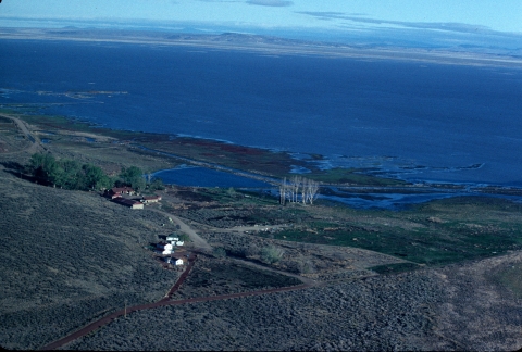
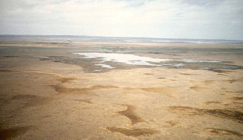
To all those who cherish this unique place where desert and water meet, the water fluctuates year to year, causing Malheur Lake and other areas to become dry to triple in size. This constant fluctuation ensures that the land rejuvenates itself by recycling nutrients, flushing out mineral salts during floods, and wind-tilling the soil during droughts. Malheur Lake is closed to the public. The best views of Malheur Lake are at Refuge headquarters on the Overlook Trail and when the water level is high at the Narrows Pullout.
Visitor Center, Nature Store and Museum
The Refuge headquarters is located 32 miles south of Burns, Oregon. The main route to the headquarters is on Highway 205 (26 miles) and 6 miles east on Sodhouse Lane. Refuge headquarters is a good starting point for your visit. The Refuge office, Visitor Center, Nature Store, and the George Benson Memorial Museum are all located at headquarters. Brochures, maps, information, recent bird sightings, and interpretive panels and exhibits are available. The George Benson Memorial Museum is open daily from sunrise to sunset. The museum contains historic taxidermy mounts of many of the birds that may be viewed on the Refuge and a variety of interpretive exhibits.
Restrooms
Restrooms are located are Refuge headquarters, Buena Vista Overlook, Krumbo Reservoir, and historic P Ranch. The Refuge Map will help you locate public restrooms on the Refuge. Please plan accordingly.
Road Conditions
Refuge roads are gravel with good clearance. Poor conditions may occur throughout the year. Vehicle pullouts are sparingly available along the 42-mile auto tour route. For larger and recreational vehicles turn arounds are limited. Make sure your vehicle and tires are in good condition and your gas tank is full. Road closures may occur when road conditions are hazardous, particularly in the fall and winter months. Call (541) 493-2612 for current road conditions.
Weather and Cell Phone Service
The Refuge is located in the high desert situated at 4,100 feet in elevation. Radical weather changes, including lightning storms and intense heat and cold, can occur quickly. Be prepared for weather extremes and traveling long distances over paved and gravel roads. Make sure your vehicle is in good condition and your gas tank is full. Carrying drinking water is essential, and mosquitoes can be ruthless during the summer months. Weak cell phone signal reception can occur on the Refuge, especially in rural areas.
Lodging, Fuel, and Other Accommodations
The Refuge does not offer lodging, fuel, and other accommodations. Many visitors stop in nearby communities for lodging, fuel, or meals. The Refuge promotes surrounding communities and encourages visitors to enjoy the many services and opportunities offered nearby. Visit Harney County Chamber of Commerce for more information.
Activities
Malheur National Wildlife Refuge connects the hearts and minds of visitors with the places and resources the Refuge protects and enlightens visitors' experiences with an understanding of, appreciation for, and knowledge about historic and natural resources, and the importance of conservation and stewardship with all the outdoor activities available. Please be mindful of wildlife and help protect their habitat by following Refuge Rules and Policies.
To protect wildlife and their habitat ALL AREAS ARE CLOSED on Malheur National Wildlife Refuge unless posted open at designated trails, sites, or facilities as determined by the Refuge.
Trails
At Malheur National Wildlife Refuge, hiking in nature is a recreational activity offered at the Refuge. It gives visitors a chance to unplug from the stresses of daily life and reconnect with the natural surroundings. Some of the best areas to enjoy the Refuge can be found on Refuge trails. Whether you want a short, easy walk or a challenging hike, you’re likely to find what you want. Some trails are paved and universally accessible. Some trails include displays on visual arts, local history, and culture, or environmental education. All of our trails have trail access information posted at the trailheads.
Trail Etiquette
- Dispose of all trash and animal waste in trash receptacles
- Pets must be kept on a leash
- Stay on the trail, and respect plants and wildlife
- Leave natural objects such as plants, animals, minerals, antlers, and objects of antiquity
- Yield to pedestrians; many Refuge routes are multi-use trails
Rules and Policies
To protect wildlife and their habitat ALL AREAS ARE CLOSED on Malheur National Wildlife Refuge unless posted open at designated trails, sites, or facilities as determined by the Refuge.
National Wildlife Refuges are places where wildlife comes first, and where people can experience the beauty of the natural world in a truly wild place. Although people are welcome, activities are regulated and monitored to ensure that impacts are minimal to the plants and animals that call the refuge “home”. View all Rules and Policies to further help protect wildlife and their habitat at Malheur National Wildlife Refuge.
Law enforcement issues should be referred to Refuge headquarters at (541) 493-2612.


