Visit Us
National wildlife refuges offer us all a chance to unplug from the stresses of daily life and reconnect with our natural surroundings.
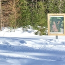
Visitors planning on hiking along refuge trails and roads should be prepared to deal with biting insects including black flies, mosquitos, and deer and moose flies. Insect repellant and/or a bug jacket are recommended in the spring and summer months. Depending on the length and location of your hike sunscreen, water, snacks, and a map and compass are recommended. Winter temperatures often drop below 0 degrees Fahrenheit. Visitors should dress appropriately during the winter months. Trail maps are available from the refuge office.
Contact Information
Moosehorn National Wildlife Refuge
103 Headquarters Road
Baring, ME 04694
(207) 454-7161
fw5rw_mhnwr@fws.gov
Activities
There are visitor activities year-round at Moosehorn National Wildlife Refuge including fishing, hunting, wildlife viewing, photography, and hiking.
Trails
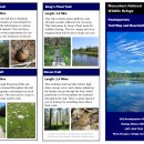
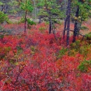
Over 50 miles of dirt roads and trails are closed to vehicles and available for hiking, biking, cross-country skiing, and snowshoeing. Several hiking trails allow access into Moosehorn's Wilderness area, a part of the National Wilderness Preservation System. This area is managed with a "hands-off" philosophy and allows hikers to experience a rare glimpse of old growth climax forests. Near the Refuge Headquarters off Charlotte Road, The Woodcock Trail offers a handicapped accessible option as well as a self guided interpretative walk.
Refuge Maps:
Baring Division
Edmunds Division
Related Documents
Moosehorn National Wildlife Refuge has two divisions and covers more than 30,000 acres.
The Northern unit of the refuge is located in Baring, ME. The Refuge Headquarters is located in the Baring Division, just south of Calais. To reach Headquarters take Charlotte Road off of Route 1. Feel free to stop by for maps and more information.
The southern division of Moosehorn is located in Edmunds, ME. Both Divisions offer hiking trails, and a short scenic driving loop. Look for the Vehicle Icon on our Refuge maps to locate where these scenic drives begin! Trails are open to hikers, and our refuge roads are open to biking, and horseback riding.
Other Facilities in the Complex
The Moosehorn National Wildlife Refuge is managed as part of the Northern Maine National Wildlife Refuge Complex, along with Aroostook National Wildlife Refuge , Sunkhaze Meadows National Wildlife Refuge, and Carlton Pond Waterfowl Production Area.
Rules and Policies
We encourage the visiting public to call this refuge their own. As with any public use area, we ask you to care for the land and wildlife resources as your own, while calling on you to observe some simple rules and regulations.
Locations


Moosehorn National Wildlife Refuge has two divisions and covers more than 30,000 acres.
The northern unit, the Baring Division, is the larger of the two units and lies just south of Calais, Maine. The Refuge Headquarters is located in this Division and provides maps and information. To reach Headquarters take Charlotte Road off Route 1 and follow signs.
The southern division of Moosehorn is located in Edmunds, Maine off Route 1. Both Divisions offer hiking trails, and a short scenic driving loop. Look for the Vehicle Icon on our Refuge maps to locate where these scenic drives begin! Trails are open to hikers, and our refuge roads are open to biking, and horseback riding.
Refuge Maps:
Baring Division
Edmunds Division
To reach Refuge Headquarters take Charlotte Road off Route 1 near Calais, Maine and follow signs. Feel free to stop by for maps and more information.


