About Us
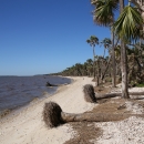
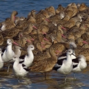
The Refuge was established in 1931 to provide wintering habitat for migratory birds. It is one of the oldest refuges in the National Wildlife Refuge System. It encompasses over 83,000+ acres spread out between Wakulla, Jefferson, and Taylor counties, and includes about 43 miles along the Gulf Coast of northwest Florida.
The Refuge includes coastal marshes, islands, tidal creeks and estuaries of seven north Florida rivers, and is home to a diverse community of plant and animal life. The Refuge also has strong ties to a rich cultural past, and is home to the St. Marks Lighthouse, which was built in 1842 (current tower) and is still in use today.
Over 17,000 acres are protected under the Federal Wilderness Act.
Longleaf Pine Land Management Research and Demonstration Area;
Globally Important Bird Area
Outstanding Florida Waters
Class 1 Air Quality area
Our History
On October 31, 1931, during the time of the Great Depression, Executive Order 5740 established the St. Marks Migratory Bird Refuge under the U.S. Department of Agriculture, Bureau of Biological Survey. The first land set aside under the Migratory Bird Conservation Act and the Six Million Dollar Fund was the 53-acre Lighthouse Reservation. This is an area of salt marshes and grass flats at the mouth of the St. Marks River, adjacent to Apalachee Bay. At the time, it was important for migrating Canada geese. On December 24, 1931, President Herbert C. Hoover signed Presidential Proclamation 1982, which established an Executive Closure Area under the authorities of the Migratory Bird Treaty Act of 1918, and the Migratory Bird Conservation Act of 1929. This prohibited hunting of migratory waterfowl in Apalachee Bay between the St. Marks Lighthouse and the Aucilla River, as well as on private lands bordering the coastal marshes. These inland timber lands were primarily purchased from Phillips Turpentine Company in subsequent years and became the nucleus of what is now the St. Marks Unit of the Refuge. It was under President Franklin D. Roosevelt that the boundaries of today's Refuge substantially took shape. Executive Order 7222, dated November 1, 1935, added approximately 10,108 acres which formed most of the current Wakulla Unit of the refuge. Executive Order 7749, dated November 22, 1937, further defined the boundaries of the St. Marks and Wakulla units, including approximately 31,445 acres. Executive Orders 7977 and 9119, dated September 19, 1938, and April 1, 1942, respectively, added approximately 22,040 acres to form what is now the Panacea Unit out of lands transferred from the Soil Conservation Service's Resettlement Administration. The original Executive Closure Order, which prohibited the taking of migratory waterfowl, was expanded by Roosevelt's Presidential Proclamation 2264 on December 13, 1937. With Presidential Proclamation 2416 on July 25, 1940, the St. Marks Migratory Bird Refuge became St. Marks National Wildlife Refuge. By 1960, the Executive Closure Order boundaries had a total of 67,563 acres. In recent years the refuge has acquired some land through timber-for-land exchanges. The timber traded under this program was slated for removal in forest prescriptions to improve wildlife habitat. Rather than sell timber directly, the refuge traded timber for land that was either within the Refuge acquisition boundary, as inholdings, or adjacent to the Refuge. Purchased by the Suwannee River Water Management District, 642 acres of land located along the Aucilla River are managed by the Refuge under a Memorandum of Understanding signed in 2000. The Refuge also manages the 305-acre Porter Tract according to a Memorandum of Understanding signed in 1999. It is owned by the State of Florida and administered by the Department of Environmental Protection, Office of Greenways and Trails. Similarly, a 334-acre portion of the Florida National Scenic Trail, located west of the Wakulla River, is managed by the Refuge under a 2002 Memorandum of Understanding. This land was acquired by the USDA Forest Service. The Refuge also administers 16 conservation easements and one government-owned property totaling 1,517 acres in northern Florida and southern Georgia.
Other Facilities in this Complex
St. Marks NWR is managed as part of the North Florida Refuges Complex. A National Wildlife Refuge Complex is an administrative grouping of two or more refuges, wildlife management areas or other refuge conservation areas that are primarily managed from a central office location. Refuges are grouped into a complex structure structure
Something temporarily or permanently constructed, built, or placed; and constructed of natural or manufactured parts including, but not limited to, a building, shed, cabin, porch, bridge, walkway, stair steps, sign, landing, platform, dock, rack, fence, telecommunication device, antennae, fish cleaning table, satellite dish/mount, or well head.
Learn more about structure because they occur in a similar ecological region, such as a watershed or specific habitat type, and have a related purpose and management needs. Typically, a project leader or complex manager oversees the general management of all refuges within the complex and refuge managers are responsible for operations at specific refuges. Supporting staff, composed of administrative, law enforcement, refuge manager, biological, fire, visitor services, and maintenance professionals, are centrally located and support all refuges within the complex.
The North Florida National Wildlife Refuge Complex encompasses the St. Marks National Wildlife Refuge and the St. Vincent National Wildlife Refuge and associated conservation easements across 13 counties in southwestern Georgia and the Florida panhandle protecting close to 95,000 acres for wildlife. The addition of Lower Suwannee National Wildlife Refuge and Cedar Keys National Wildlife refuges unifies our national wildlife refuges along Florida’s “Big Bend” or “Nature Coast,” which is one of the largest, undeveloped, mostly privately-held coastal areas in the nation.


