
All of the pool maps for the refuge showing where you can hunt, fish, and recreate are found here: Pool Maps 4-14. These maps outline in more detail the closed areas, sanctuaries, slow no wake areas, etc.
Visit Us
National wildlife refuges offer us all a chance to unplug from the stresses of daily life and reconnect with our natural surroundings.
Hunting and fishing have a rich history and tradition on the refuge. Most hunters seek waterfowl from boats and blinds in the marshes. Other upland hunting occurs on islands and flood plain forest. Consult the refuge hunting brochure for additional information. If fishing is your sport, the refuge is known for walleye, largemouth bass, crappie, catfish and bluegill. There are year-round fishing opportunities including many ice fishing locations.
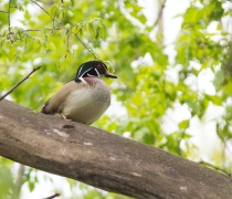
There are observation decks, pull-offs and canoe and bike trails to help you observe the natural wonders of the Upper Mississippi River National Wildlife and Fish Refuge. Although boating provides the most intimate look at this river refuge, many visitors enjoy viewing the wild and scenic beauty of the refuge from blufftop overlooks in state and local parks that border the refuge. Riverbanks offer you a place to see a variety of wildlife - from muskrats and beavers to turtles and frogs. Turkeys and white-tailed deer are common in the forested areas.
Driving Directions
Visitor Center in Onalaska, Wisconsin
Address: N5727 County Road Z, Onalaska, Wisconsin 54650. If you type this address into Google Maps, put a space in the address: N 5727 County Road Z.
From Dakota, Minnesota:
- Head east on I-90
- Take exit 3B, turn left to follow WI-35N - 4.7 miles
- Turn left at stoplight onto County Road OT. - 0.6 miles
- Turn left at the first stop sign onto County Road ZN. - 1.1 miles
- Continue to the junction of County Roads ZN and Z. - 0.2 miles
- Turn right onto County Road Z and use the left turn lane to turn left and enter the Visitor Center parking lot
From Sparta, Wisconsin:
- Head west on I-90
- Take Exit 3 for US-53S / WI-35 Toward La Crosse / Onalaska - 0.1miles
- Keep Right at the fork and merge onto WI-35N - 4.1 miles
- Turn left at the stoplight onto County Road OT. - 0.6 mi
- Take the left at the first stop sign onto County Road ZN - 1.1 miles
- Continue to the stop sign and the junction of County Roads ZN and Z - 0.2 miles
- Turn right onto County Road Z and use the left turn lane to turn left and enter the visitor center parking lot
Savanna District Office and Ingersoll Wetlands Learning Center in Thomson, Illinois
Address: 7071 Riverview Road, Thomson, Illinois 61285
From Fulton, Illinois:
- At the intersection of IL-84 and IL-136
- Head north on IL-84 N for 12.7 miles
- You will go through Thomson, Illinois
- Turn left onto Riverview Road, go 0.7 miles
- Turn left to enter the Ingersoll Wetlands Learning Center parking lot
From Elizabeth / Galena, Illinois:
- From US Hwy 20 E / W
- Head south on IL-84 S for 4.9 miles
- In Hanover, turn left onto IL-84 S/Jefferson St - road makes a sharp left curve
- Continue to follow IL-84 S for 15.5 miles
- You will go through Savanna, Illinois
- Turn right onto IL-84 S/Viaduct Road - at stop light
- Continue to follow IL-84 S for 3.9 miles
- Turn right onto Riverview Road go 0.7 miles
- Turn left to enter the Ingersoll Wetlands Learning Center parking lot
From Lanark, Illinois:
- From US-52(64) and Broad St (IL-73)
- Head west on US-52 (64) for 16.5 miles
- You will pass through the outskirts of Mount Carroll, Illinois
- Turn left onto IL-84 S / Viaduct Road - at stop light
- Continue to follow IL-84 S for 3.9 miles
- Turn right onto Riverview Road, go 0.7 miles
- Turn left to enter the Ingersoll Wetlands Learning Center parking lot
Fees
There is no fee to visit the refuge, but certain activities may require a special use permit that has an associated fee, such as trapping and commercial activities.
Restrooms
Restroom facilities can be found at several locations along the river. Many may be managed by state agencies or private entities, and there a number of seasonal porta potties at various boat landings or overlooks - depending on river water levels. Refuge-owned restrooms include public restrooms inside the La Crosse District Visitor Center, open during visitor center open hours. Public restrooms are located outside the La Crosse District Visitor Center open during daylight hours. Public restrooms are located inside the Ingersoll Wetlands Learning Center open during office hours.
Points of Interest
Let our staff and volunteers at the visitor center help you plan your visit! This is a great starting point for you to become more familiar with the refuge and the wildlife that live here. You can watch a 10-minute refuge orientation video, explore the River Walk exhibit to see what lives below the river’s surface. You can also browse nature and wildlife exhibits and obtain maps and brochures while you’re there. Collocated is the Prairie Wind Nature Store, managed by the Friends of the Refuge – Mississippi River Pools 7 and 8. They offer relevant field guides and other educational items.
What To Do
If you have 15 minutes
- Stop at one of the many overlooks along the river for wildlife observation and photography. The best time of year to see the tundra swan migration is usually from late October through mid-November, where they will gather up near the Brownsville Overlook, just south of Brownsville, Minnesota on Hwy 26.
If you have one hour
- Drop into the La Crosse District Visitor Center! Here are just a few things you can do while you are there:
- View a 10-minute movie about the seasonal sights and sounds on the refuge
- Explore interactive exhibits about the diverse wildlife and habitats
- Enjoy the River Walk exhibit, which allows you to walk on water and see what lies below the surface of the river.
- Walk two miles of paved and packed gravel trails which wind through the sand prairie
If you have half a day or more
- Dust off your canoe, kayak or boat and get onto the water! There are endless fishing opportunities, canoe trails and islands you can stop at to go for a swim or eat some lunch
- Get your waders on and grab your decoys! Duck hunting draws visitors from all over the country to take part in this longstanding tradition
- Get out your maps and set up a route on the Great River Roads! There are many places to stop along the way, including overlooks, visitor centers and trails.
Know Before You Go
Areas throughout Upper Mississippi River National Wildlife and Fish Refuge are designated as closed or restricted use areas, usually autumn to spring, to protect migrating waterfowl or for public safety. These areas are marked with orange topped special regulation signs and list the restrictions and effective dates or seasons. Please read and heed these signs. Maps of these areas are available at refuge offices.
Visitor Tips
- If you are coming to the refuge to view wildlife and are not sure where to start, stop by the La Crosse District Visitor Center to learn more and obtain maps or brochures to guide your way
- The best time to view wildlife is generally in the morning or dusk when birds and animals are moving the most
- Need some supplies to explore? Checkout one of our free backpacks from the La Crosse District Visitor Center! They come with binoculars, field guides and activities to help guide your adventure!
- There are a number of canoe trails to explore along the refuge. First, determine if you would like to do a loop or if you can shuttle a vehicle to decide which route is best for you. Decide on the length of trail you would like and skill level, pick your location and hit the river!
Activities
There is a wide variety of recreational opportunities at Upper Mississippi River National Wildlife and Fish Refuge. There is something for everyone!
Trails
Winona District Hiking Trails
River Road
Open season: Open year round - Walking spring to fall, snow shoeing and cross-country skiing in winter.
Length: 1.5 miles
Location of trail: Aghaming Park Trailhead (W494 Aghaming Park Road, Buffalo, Wisconsin)
Surface: Sand/dirt
Difficulty: Flat - subject to seasonal flooding
Information: The River Road trail parallels the Mississippi River backwaters taking the user through mature floodplain forests. Great birdwatching opportunities year round. Provides access to Sam Gordy's Slough known for year-round fishing opportunities. Not open to biking or motorized vehicles
Death Road
Open season: Open year round - Walking spring to fall, snowshoeing and cross-country skiing in winter.
Length: 0.5 miles
Location of trail: Trail begins between the Aghaming Park Trailhead (W494 Aghaming Park Road, Buffalo, Wisconsin) and the Winona Boathouse driveway.
Surface Sand/dirt
Difficulty: Flat
Information: Death Road is an abandoned dike that will take the user through mature floodplain forest and backwater wetlands. Great birdwatching opportunities year round. Not open to biking or motorized vehicles.
La Crosse District Hiking Trails
Visitor Center Trails
Open season: Open year-round from dawn to dusk. Visitors may walk the trails during all seasons. Please keep in mind that trails are not maintained in winter months to allow for cross-country skiing and snowshoeing.
Length: About 2.5 miles
Location of trail: N5727 County Road Z, Onalaska, Wisconsin 54650
Surface: Partially paved, partially packed gravel. Paved pathways are ADA accessible.
Difficulty: Easy - The paved trails are flat and packed gravel trails have only a slight slope. Additional parking lots allow for shorter walks if desired.
Information: The trails begin at the visitor center and wind through a restored sand prairie. Paved pathways lead from the visitor center to the Lake Onalaska Overlook, connecting to longer packed gravel loops along the way. Plenty of native prairie plants provide year round color and are a-buzz with wildlife from late spring through fall. Visit each season to enjoy the changes! Outdoor restrooms are available year round. Open to bicycling spring to fall.
Upper Halfway Creek Marsh Area Dike Walk
Open season: Open to walkers year round from dawn to dusk, except for signed parts of the dikes that are closed during mid-spring and summer to respect nesting waterfowl. Open to snowshoeing in the winter.
Length: The combined length of all three dikes is about 1.25 miles
Location of trail: The Upper Halfway Creek Marsh Area is located on the north side of County Road ZN in Onalasaka, Wisconsin, about a half mile east of the visitor center. Parking is available at a small gravel lot at the trail head.
Surface: Mowed grass and packed earth. The dikes are not formal trails and are not maintained for walking but are mowed periodically to allow staff to access water control structures, to maintain the integrity of the dikes, and for other management purposes.
Difficulty: Easy to Moderate. The dikes are mostly flat with some small slopes, but the surface is uneven and can be soft in wet weather.
Information: The dikes begin at the Upper Halfway Creek Marsh Area parking lot. Running between restored wetlands and wet meadows, three short dikes offer a peek at marsh life through the seasons! Wetland waterfowl, songbirds, cranes and herons frequent the area from mid-March through mid-fall, and in winter it’s a great spot to see migratory and residential raptors and evidence of winter mammals.
Shady Maple Interpretive Trail
Open season: Open year round, dawn to dusk for walking and cross-country skiing/snowshoeing in the winter.
Length: 1.18 mile loop
Location of trail: The Shady Maple Interpretive Trail is located within Goose Island County Park, about one mile from the park entrance on the left-hand side of the road as you drive in. Parking is available at a paved lot at the trail head.
Surface: Wide trail, a mix of grass and sand, little to no elevation gain. Conditions can be wet in the spring and summer.
Difficulty: Easy
Information: The Shady Maple Interpretive Trail takes visitors through the bottomland forest with views of the wetlands beyond. Look and listen for frogs calling in the spring, songbirds migrating through in the spring and summer, and residential woodpeckers hard at work in the fall and winter. From mid-September through freeze-up, the wetlands beyond are home to thousands of migrating waterfowl. Each season offers a different experience! From mid-October through the end of the state waterfowl hunting season, this trail goes through a section of the refuge that is closed to hunting to allow waterfowl to rest and feed during the fall migration. Visitors are asked to take extra caution not to disturb the birds during this time period
McGregor District Hiking Trails
Sturgeon Slough
Open season: Open year round
Length: 0.7 miles
Location of trail: Between Prairie du Chien, Wisconsin and Marquette, Iowa on Hwy 18
Surface: Earth
Difficulty: Easy
Information: The Sturgeon Slough Trail is an out and back trail that begins at the Sturgeon Slough parking lot. The trail winds through floodplain forest habitat and backwater sloughs of the Mississippi River and is prone to flooding.
Ballard Bluff Hiking Trail
Open season: Open year round, daylight use only. Hiking, cross country skiing are allowed, pets must be on a leash. Not allowed: Horses, bicycles or motorized vehicles.
Length: 1.0 miles
Location of trail: South of Pikes Peak on Hwy X56 and 175th Street, Iowa
Surface: Earth
Difficulty: Medium
Information: The Ballard Bluff Hiking Trail is a loop trail which begins in the parking lot. The trail winds through tall grass prairie restoration and oak savanna areas.
John Deere Marsh Trail
Open season: Open year round
Length: 1.48 miles
Location of trail: North of Dubuque, Iowa on Riverside Road near the John Deere Plant
Surface: Gravel
Difficulty: Easy
Information: The John Deere Marsh Trail is an out and back trail that begins at the parking lot. The trail winds through floodplain forest habitat and wetlands of the Mississippi River.
Goetz Island Trail
Open season: Open year round
Length: 0.6 miles
Location of trail: Southside of Guttenberg, Iowa
Surface: Earth
Difficulty: Easy
Information: The Goetz Island Trail is a loop trail which begins in the southeast corner of the Guttenberg Landing parking lot. The trail winds through bottomland forest and is prone to flooding.
Cold Springs Fishing Trail
Open season: Open year round
Length: 0.1 miles
Location of trail: South of Cold Springs Landing off Hwy. 35
Surface: Concrete, ADA compliant
Difficulty: Easy
Information: The Cold Springs Fishing trail is an out and back trail which begins in the Highway 35 pull off parking lot. The trail allows handicap access to a fishing platform at the bottom of the trail.
Savanna District Hiking Trails
Pleasant Creek Trail
Open season: Voluntary avoidance October 15 through the end of the last Iowa State Duck Hunting Season.
Length: 4.60 miles
Surface: Grass
Difficulty: Easy - Moderate
Information: Loop / continuous trail. Hiking, walking, bicycling, snowshoeing, cross-country skiing
Spring Lake Trail
Open season: Closed October 1 through the end of Illinois State Duck Hunting Season
Length: 8.70 miles
Surface: Grass
Difficulty: Easy - Moderate
Information: Accessed via the Spring Lake parking lot. The northern section is 4 miles and a continuous loop, where the southern section is 4.70 miles one way, so a there and back route. Hiking, walking, bicycling, snowshoeing, cross-country skiing.
Duck Foot Marsh Trail
Open season: Open all year
Length: 1.90 miles
Surface: Gravel
Difficulty: Easy
Information: Loop / continuous trail. Hiking, walking, bicycling, snowshoeing, cross-country skiing
Prickly Pear Hiking Trail
Open season: Open all year round
Length: 1.29 miles
Surface: Asphalt
Difficulty: Easy
Information: 0.25 miles of the trail is accessible, the remaining 1.04 miles of the trail is a loop trail. Hiking, walking and snowshoeing
Great River Trail
Open season: Open year round
Length: 3.21 miles, in two sections. The northern section (1.42 miles) is accessible via Spring Lake or the Ingersoll Wetlands Learning Center, which has a small 0.49 miles loop, included in overall miles. The southern section (1.79 miles) goes through Thomson prairie and is accessed via the entrance of the Thomson Causeway, U.S. Army Corps of Engineers or from the southern portion of the prairie where Great River Trail enters from a roadway.
Surface: Asphalt
Difficulty: Easy
Information: Hiking, walking, bicycling, snowshoeing, cross-country skiing. The 3.21 miles sections are the U.S. Fish and Wildlife Service portion of a larger trail system that consists of 350 miles.
Description and Directions of Water Trails on the Upper Mississippi River
Maps of the Water Trails
Chippewa River Water Trail
Length: 6.8 miles
Location of trail: Pool 4
Difficulty: Moderate to difficult due to current
Information: Paddle with the flow down the Chippewa River to the Mississippi River main navigation channel and return against a moderate current in Government Light Slough. Not recommended during periods of high river flow. Expect increased power boat travel on the Mississippi River portion of the trail on holidays and weekends. The trail ends approximately 0.5 mile east of the launch site at Tim’s Slough Landing.
Directions: The Chippewa River Landing is located on the eastern shore of the Chippewa River just north of Highway 35 approximately four miles west of Nelson, Wisconsin or four miles east of Pepin, Wisconsin.
Nelson-Trevino Water Trail
Length: 4.5 miles
Location of trail: Pool 4
Difficulty: Moderate
Information: There is a stretch where you will be paddling against the current. During high water levels and windy days, it will require strong paddling.
Directions: If coming from Wabasha, Minnesota, take HWY 25, east toward Nelson, Wisconsin. If coming from Nelson, Wisconsin, take HWY 25, west toward Wabasha, Minnesota. Pontoon Slough Landing is located on the south side of HWY 25.
Finger Lakes Water Trail
Length: 6.1 miles
Location of trail: Pool 5
Difficulty: Moderate to Difficult
Information: This trail is best when water levels are high. There are two loops, a shorter one mile loop or the longer 5.20 mile loop. During low or normal pool conditions, you will need to portage your canoe between 1st Lake and Wiggle Waggle Slough. This trail winds through the braided streams and sloughs of the Upper Mississippi River.
Directions: There are two access points: Minnesota Department of Natural Resources Canoe Access or Pioneer Landing. From Kellogg, Minnesota:
- Take Highway 61 north, turn right onto County Road 81
- Turn left onto County Road 81
- Turn right onto County Road 24, continue onto N County Road 24
- Turn right onto Prairie Lane
- Turn right onto Pioneer Drive
- You can access either using the Minnesota Department of Natural Resources Canoe Access area or Pioneer Landing
Halfmoon Water Trail
Length: 5.1 miles
Location of trail: Pool 5
Difficulty: Moderate to Difficult
Information: Difficult during high water. Murphy’s Cut can be impassable during high water. Difficult due to vegetation towards the end of summer. Recommended for experienced paddlers.
Directions: From Kellogg, Minnesota:
- Take Hwy 61 South
- Turn left onto County Road 84
- Turn right onto West Newton Road
- Turn right into Halfmoon Landing
Verchota Trail
Length: 11.3 miles
Location of trail: Pool 5A
Difficulty: Difficult
Information: The length of this trail makes it a more difficult adventure and you will be going against the current in the beginning. Recommended for experienced paddlers. However, you can put in at Bass Camp and go with the flow of the river following the canoe route signs to Verchota Landing instead of doing the entire loop from Verchota Landing.
Directions: From Winona, Minnesota, take Prairie Island Road to Verchota Landing
Aghaming Water Trail
Length: 6.7 miles
Location of trail: Pool 6
Difficulty: Moderate to Difficult
Information: This is a looped trail, and you will be paddling against the current on the return trip
Directions: From Winona:
- Cross the interstate bridge and turn right onto Latch Island
- Cross over the concrete bridge and turn right onto the dirt road
- Launch your canoe or kayak from the shore
- The dirt road can be muddy with large potholes of water
- This trail is not usable during floods
Long Lake Water Trail
Length: 5 miles
Location of trail: Pool 7
Difficulty: Easy
Information: This is a looped trail out of Long Lake Boat Landing. It can take three to four hours to complete. It is located in the backwaters, which has slower moving water than the main channel.
Directions: From Trempealeau, Wisconsin:
- At the intersection of Highway 35 and Fremont Street, head south on Fremont Street (Lake Road)
- Past the railroad tracks 1.5 miles to the Long Lake Landing
Browns Marsh Canoe Area
Length: No Marked Trail
Location of trail: Pool 7
Difficulty: Easy
Information: On this part of the river, you are paddling in a shallow lake. Aquatic vegetation is thick in some areas and the water can be quite shallow. In some places there are floating mats of vegetation that make navigation difficult. This is designated an Electric Motor Only Area. These areas are closed year round to all motorized vehicles and watercraft except watercraft powered by electric motors or non-motorized means.
Directions: From Onalaska, Wisconsin:
- Take HWY 35 North, turn left onto County Road OT
- Turn Left onto County Road ZN, turn right onto County Road Z
- Follow County Road Z to the end of the road - you will see a dead end sign - and turn right onto Lytle’s Road for the Lytle’s Canoe Access Point
Lake Onalaska Water Trail
Length: 4-7 miles
Location of trail: Pool 7
Difficulty: Easy to Moderate
Information: Four miles to Fred Funk Landing and seven miles to Moseys from Lytle's Landing. This trail takes you on the backwaters of the Black River. Boat traffic is quite light for the first three miles or so and then it can pick up as you get closer to the Fred Funk Landing. This is an easy float that takes two to four hours. As always, know your route and conditions may change with water levels and after storms where trees could be down. You will need to have a shuttle vehicle to get from the Fred Funk or Mosey’s Boat Landings to get back to the Lytles Landing Canoe Launch.
Directions: From Onalaska, Wisconsin:
- Take HWY 35 North, turn left onto County Road OT
- Turn Left onto County Road ZN, turn right onto County Road Z
- Follow County Road Z to the end of the road - you will see a dead end sign - and turn right onto Lytle’s Road for the Lytle’s Canoe Access Point
Goose Island Water Trail
Length: 7 miles
Location of trail: Pool 8
Difficulty: Moderate
Information: This trail is a loop and can take four to five hours to complete. You will be paddling against the current for one-half of your trip. You may encounter strong currents, especially during high water events. Canoe rentals available from Goose Island County Park.
Directions: From La Crosse, Wisconsin: Take Highway 35 South to County Highway GI West - the road into Goose Island County Park. The canoe trail may be accessed from any of the four boat ramps in Goose Island County Park.
Reno Bottoms Water Trail
Length: 3 -14 miles
Location of trail: Pool 9
Difficulty: Easy to Moderate
Information: There are three takeout points along the trail. However, from April to early June, you should take out at Visger’s Landing during high water conditions.
- Reno to New Albin Landing: 14 miles (4-8 hours) See below for description of the stretches of river.
- Spillway to Millstone Landing: 7 miles (2-4 hours). Pickerel Slough merges with the canoe trail about half-way to Millstone Landing. Use the map and follow the signs to make your way through the maze of islands and marsh.
- Millstone to Visger’s Landing: 3 miles (1-2 hours) During high water, you will be able to paddle directly to the landing from Ice Haul Slough, located about 0.5 miles south of Millstone Landing. If the river is low, you will have to go around the islands and paddle a short distance upstream to the landing.
- Visger’s to New Albin Army Road Landing: 4 miles (1-2 hours). The trail crosses large expanses of open water; be aware of wind conditions.
Directions:
- The trail is located off HWY 26, just east of Reno, Minnesota
- Be prepared to carry your gear from the parking lot across the railroad tracks, and down to the launch site on the south side of Lock and Dam 8 spillway
Blue Heron Water Trail
Length: 3-10 miles
Location of trail: Pool 9
Difficulty: Moderate to Difficult
Information: There are two launch/take-out points along the trail. However, from April to early June, if the river levels are high, you should consider launching from Blackhawk Park.
Section: New Albin Landing to Blackhawk Park is a three mile trail and usually takes one to two hours. This is considered a moderate skill paddle through Minnesota Slough to Lost Channel crossing the Main Channel on to Blackhawk Park boat ramp
Section: Blackhawk Park to Big Slough Landing is a seven mile trail and usually takes three to five hours. Blackhawk Park to Big Slough Landing crosses the main channel. Follow the signs to make your way through the maze of islands and marshes.
New Albin to Big Slough Landing is a 10 mile trail and usually takes five to seven hours. This trail bypasses crossing over the main channel to Blackhawk Park.
Directions:
- The trail head is located east of New Albin, Iowa
- From Highway 26, head east on Ross Avenue
- Turn right (South) on Main Street
- Turn left (East) on Elm Street
- Elm Street becomes Army Road
- Follow Army Road to the New Albin Boat Landing.
- Blackhawk Park is in Wisconsin offering lunch/take-out point near the halfway point of the trail.
- To use Blackhawk Park Landing, head west from Highway 35 on County Road BI. The trail is posted to Big Slough Landing near Lansing, Iowa.
Ambro Slough Canoe Area
Length: No Marked Trail
Location of trail: Pool 10
Difficulty: Easy
Information: This part of the river you are paddling in a shallow lake. Aquatic vegetation is thick in some areas and the water can be quite shallow. In some places, there are floating mats of vegetation that make paddling difficult. This is designated an Electric Motor Only Area. These areas are closed year-round to all motorized vehicles and watercraft except watercraft powered by electric motors or non-motorized means.
Directions:
- From Prairie du Chien, Wisconsin:
- Head north on WI-35/Great River Road
- Turn left onto County Road K
- Take the first right toward Ambro Road
Johnson Slough Water Trail
Length: 6.1 miles
Location of trail: Pool 10
Difficulty: Moderate
Information: You will paddle against the current for half of this trail. The trail follows the edge of the main channel for approximately three miles.
Directions: From McGregor, Iowa take Hwy 18 south to County Road X56, turn left into the Sny Magill Unit of Effigy Mounds National Park and Sny Magill River access.
Wyalusing State Park Canoe Area
Length: No Marked Trail
Location of trail: Pool 10
Difficulty: Easy
Information: Bring your own canoe or kayak or rent them from the concession stand in the Peterson Shelter in the Wisconsin Ridge Campground in Wyalusing State Park. You will be paddling in a backwater area. When you approach the main channel there are big stop signs instructing you to turn around.
Directions: Access is from the Wyalusing State Park. From Prairie du Chien, Wisconsin, head south on US Highway 18 and State Highway 35, turn west on County Road C just south of the Wisconsin River bridge. Turn right on County Road X and go one mile to the park entrance. Follow signs to boat landing.
Spring Lake Canoe Area
Length: No Marked Trail
Location of trail: Pool 13
Difficulty: Easy
Information: Though this is a canoe area, there is no marked trail – visitors may paddle throughout. No Public Access from October 1 to the end of the state waterfowl season.
Directions: From Savanna, Illinois head south on Route 84 approximately 7 miles, parking at observation area.
Rock Creek Water Trail
Length: 5.3 miles
Location of trail: Pool 14
Difficulty: Easy
Information: This is a marked looped trail.
Directions: From Camanche, Iowa take Hwy 67 south to Rock Creek County Park.
Lost Lake Water Trail
Length: 2.9 miles
Location of trail: Pool 14
Difficulty: Easy
Information: This marked trail is part of the Rock Creek Canoe Trail.
Directions: From Camanche, Iowa take Hwy 67 south to Rock Creek County Park
Wapsipinicon River Water Trail
Length: 10 miles
Location of trail: Pool 14
Difficulty: Moderate to Difficult
Information: This is a one-way marked trail trip. Paddlers must plan to have a shuttle vehicle. Launch on Hwy 67 and paddle down the Wapsipinicon River. Head north on the Mississippi River into the Rock Creek Canoe Loop.
Directions: From Princeton, Iowa head north on Hwy 67. There is an access to the Wapsipinicon River off of Hwy 67.
Other Facilities in the Complex
Driftless Area National Wildlife Refuge is managed by the McGregor District of the Upper Mississippi River National Wildlife and Fish Refuge.
Trempealeau National Wildlife Refuge is supervised by the La Crosse District of the Upper Mississippi River National Wildlife and Fish Refuge.


Rules and Policies
The refuge is known for providing great opportunities for waterfowl hunting, fishing and wildlife observation. Refuge hunting and fishing seasons generally follow state seasons and regulations. To conserve this special place and safeguard the experience for all, please refer to specific rules and policies before you visit. Areas throughout the refuge are designated as closed or restricted use areas, usually fall to spring, to protect migrating waterfowl or for public safety. These areas are marked with orange-topped special regulation signs and list the restrictions and effective dates or seasons. Please contact the refuge if you have questions.
Locations


Stop in to enjoy FREE interactive exhibits for all ages! Discover native wildlife, habitats on the refuge, and the natural and cultural history of the area. Walk on water as you step over a glass floor "river bed" to see what's going on in the water below! Relax and listen to oral histories about life on the river and enjoy a short film illustrating the refuge through the seasons. Chat with a refuge volunteer or staff member to answer questions about the refuge. Visit the non-profit Prairie Wind Nature Store, operated by the Friends of the Refuge - Mississippi River Pools 7 & 8.
The Visitor Center is surrounded by about 180 acres of restored prairie with two miles of mostly flat trails winding through native grasses and flowers. More than 40 species of flowers bloom by mid-summer. A paved loop and paved trail guide visitors to the Lake Onalaska Overlook, offering views of the Mississippi River backwaters. Bald eagles, songbirds, and many species of water birds move through the river across the year!
Indoor and outdoor scavenger hunts are available at the front desk! Federal recreational lands passes and Federal Duck Stamps may be purchased with cash or check. "Let's Go Outside" backpacks containing nature journaling activities and a pair of binoculars may also be check-ed out at the front desk for use on the prairie trails.
We are very excited to offer a Junior Refuge Manager and BARK Ranger program available in-person at the La Crosse District Visitor Center! Pick up a Junior Refuge Manager activity sheet at the front desk and complete five of the nine activities to earn a free badge.
Your canine companions can become a B.A.R.K Ranger and earn a free bandana too! B.A.R.K. Rangers and their human companions help make the refuge a great place for people and wildlife by bagging their waste, always staying on a six-foot leash, respecting wildlife, and knowing which trails they're permitted to go on. Please call ahead so a staff member or volunteer can arrange to meet you and your pet outside the Visitor Center to be sworn in, 608-779-2399.
From Dakota, Minnesota:
Head east on I-90.
Take exit 3B, follow WI-35N. (4.7 miles)
Turn LEFT at stoplight onto County Road OT. (.6miles)
Turn LEFT at the first stop sign onto County Road ZN. (1.1 miles)
Continue to the junction of County Roads ZN and Z. (.2 mi)
Turn RIGHT onto County Road Z and use the left turn lane to turn LEFT and enter the Visitor Center parking lot.
From Sparta, Wisconsin:
Head west on I-90
Take Exit 3 for US-53S/WI-35 Toward La Crosse/Onalaska. (.1mi)
Keep Right at the fork and merge onto WI-35N (4.1 mi)
Turn LEFT at the stoplight onto County Road OT. (.6 mi)
Take the LEFT at the first stop sign onto County Road ZN. (1.1)
Continue to the stop sign and the junction of County Roads ZN and Z. (.2 mi)
Turn RIGHT onto County Road Z and use the left turn lane to turn left and enter the visitor center parking lot.


From Fulton, Illinois:
- At the intersection of IL-84 and IL-136
- Head north on IL-84 N for 12.7 miles
- You will go through Thomson, Illinois
- Turn left onto Riverview Road, go 0.7 miles
- Turn left to enter the Ingersoll Wetlands Learning Center parking lot
From Elizabeth / Galena, Illinois:
- From US Hwy 20 E / W
- Head south on IL-84 S for 4.9 miles
- In Hanover, turn left onto IL-84 S/Jefferson St - road makes a sharp left curve
- Continue to follow IL-84 S for 15.5 miles
- You will go through Savanna, Illinois
- Turn right onto IL-84 S/Viaduct Road - at stop light
- Continue to follow IL-84 S for 3.9 miles
- Turn right onto Riverview Road go 0.7 miles
- Turn left to enter the Ingersoll Wetlands Learning Center parking lot
From Lanark, Illinois:
- From US-52(64) and Broad St (IL-73)
- Head west on US-52 (64) for 16.5 miles
- You will pass through the outskirts of Mount Carroll, Illinois
- Turn left onto IL-84 S / Viaduct Road - at stop light
- Continue to follow IL-84 S for 3.9 miles
- Turn right onto Riverview Road, go 0.7 miles
- Turn left to enter the Ingersoll Wetlands Learning Center parking lot