


Visit Us
National wildlife refuges offer us all a chance to unplug from the stresses of daily life and reconnect with our natural surroundings.
Please check out the different visitor activities that are available to the public prior to coming. You must understand the rules and regulations prior to participating in these activities.
We suggest bringing bug repellent and plenty of drinking water. We ask you to remember that the refuge is “carry in, carry out”, so please do not leave anything behind. Please stay on the trails and in designated areas.
Please note that dogs are only allowed on the Liberty Loop Trail, utilizing the parking lots at Oil City Road or Owens Station Road. All dogs must be controlled on a leash at all times. Service dogs are allowed on all refuge trails and facilities.
Activities
The beauty of Wallkill River National Wildlife Refuge can be explored through a variety of visitor activities. These activities include wildlife observation, wildlife photography, interpretation, environmental education, hunting, and fishing. In addition, there are opportunities to enjoy other outdoor recreational activities on the refuge. Whether you are a hunter, birder, educator, or just hoping to learn more about the natural world, the refuge has something for you.
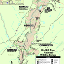
Trails
The refuge headquarters is located at 1547 County Route 565, (Glenwood Road), Sussex, NJ 07461. When using a navigational device, enter only 1547 Glenwood Road, Sussex, NJ 07461. The Dagmar Dale Nature Trail is located at the Headquarters as well as public bathrooms which are open daily year round.
Liberty Loop Trail, 7 miles north of the headquarters is a popular visitor location and well known for the outstanding opportunity it provides for wildlife observation and photography as well as a 2.5 mile nature trail. Please note that dogs are only allowed on the Liberty Loop Trail, utilizing the parking lots at Oil City Road or Owens Station Road. All dogs must be controlled on a leash at all times. Service dogs are allowed on all refuge trails and facilities.
Hidden Ponds Trail: a new trail that opened in 2022, this trail forms a loop that is less than 1 mile in length. The trail may be accessed off Lake Wallkill Road at our Hidden Ponds entrance or off of the Liberty Loop trail.
The Winding Waters Trail, located 0.5 mile west of the Liberty Loop trailhead, offers another 2.1 miles of trail along the river and through restored fields and fishing/canoe access at the trailhead. Please note that this trail closes in September, November, and December of each year due to the New York State deer hunt.
Owens Station Crossing (located at 136 Owens Station Road, Sussex NJ) is one of the refuge's most-visited public use areas. It features an accessible dock for fishing and launching kayaks or canoes, a pavilion with picnic tables, and a public restroom. Beautiful pollinator gardens, ample parking, and easy access to the refuge's Timberdoodle and Liberty Loop Trails make this a convenient starting point for exploring the refuge. Various programs are held at this location throughout the year, during which time a small gift shop may also be open.
Bassett’s Bridge fishing and canoe launch is a popular location for river access. A large parking area with a boardwalk to the water’s edge provides paddlers and anglers opportunity to enjoy the beauty of the Wallkill River.
The Wood Duck Nature Trail, conveniently located just off Route 23 is a hiking trail that provides year round enjoyment for people of all ages. Established on an abandoned railroad bed, this 1.6 mile trail is wheelchair accessible for the first 0.6 mile.
Related Documents
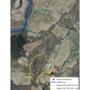
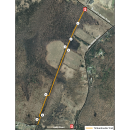
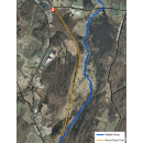
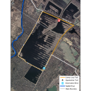
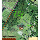
Below are maps of the refuge:
Rules and Policies
Unlike national parks, state parks, and state forests, the management priority at national wildlife refuges is "Wildlife First." These lands are managed by the U.S. Fish and Wildlife Service, which is the only agency of the U.S. Government whose primary responsibility is fish, wildlife, and plant conservation. Public uses of national wildlife refuges must be compatible with plant and animal conservation. Our guiding legislation identifies priority public uses on national wildlife refuges that can be allowed if they are compatible with the management of that refuge for wildlife.
Please note that dogs are only allowed on the Liberty Loop Trail, utilizing the parking lots at Oil City Road or Owens Station Road. All dogs must be controlled on a leash at all times. Service dogs are allowed on all refuge trails and facilities.
Locations


The refuge headquarters is located at 1547 County Route 565, (Glenwood Road), Sussex, NJ 07461. When using a navigational device, enter only 1547 Glenwood Road, Sussex, NJ 07461. Telephone number is 973-702-7266. The Dagmar Dale Nature Trail is located at the Headquarters as well as public bathrooms which are open daily year round. A small visitor center with exhibits is open weekdays from 8:00 to 4:30. Federal Duck Stamps and Access Passes are available for purchase at this location. Various environmental educational programs are conducted in and around the refuge headquarters throughout the year.
Owens Station Crossing (located at 136 Owens Station Road, Sussex NJ) is one of the refuge's most-visited public use areas. It features an accessible dock for fishing and launching kayaks or canoes, a pavilion with picnic tables, and a public restroom. Beautiful pollinator gardens, ample parking, and easy access to the refuge's Timberdoodle and Liberty Loop Trails make this a convenient starting point for exploring the refuge. Various programs are held at this location throughout the year, during which time a small gift shop may also be open.
Bassett’s Bridge fishing and canoe launch is a popular location for river access. A large parking area with a boardwalk to the water’s edge provides paddlers and anglers opportunity to enjoy the beauty of the Wallkill River.
Traveling North on Interstate 95 from South Jersey
- Interstate 95 North (NJ Turnpike).
- Interstate 287 North.
- State Route 23 North.
- County Route 565 North (Glenwood Rd).
- Refuge headquarters is 1.5 miles on left.
Traveling North on State Route 206 from South Jersey
- State Route 206 North.
- County Route 565 (9 miles).
- At junction of State Route 23/County Route 565 North, turn right.
- Travel approximately 1 mile to traffic light.
- At light, turn left.
- Continue on County Route 565 North (Glenwood Rd).
- Refuge Headquarters is 1.5 miles on left.
- Traveling East on Interstate 84 from Pennsylvania
- Interstate 84 East.
Travel across Delaware River to New York State
- Take New York State Exit 1 (Sussex, NJ).
- Travel south on State Route 23.
- Continue on State Route 23 through the borough of Sussex.
- Turn left on County Route 565 North (Glenwood Rd).
- Refuge Headquarters is 1.5 miles on left.
Traveling West on Interstate 84 in New York State
- Interstate 84 West.
- Take Exit 3W (Middletown)
- Turn right off exit ramp, then immediately get in left turning lane.
- Turn left on Route 6W.
- Travel 3.5 miles to Slate Hill.
- Turn left onto Route 284 South.
- Travel 9.1 miles to Unionville.
- Turn left onto State Line Rd.
- After 1.3 miles, you pass over the Wallkill River (State Line turns into Oil City Rd).
- Continue another 1.3 miles to the stop sign.
- Turn right onto Liberty Corners Rd (This will become Lake Wallkill Rd. when you cross into New Jersey).
- Travel 1.4 miles to a fork in the road; stay left on Lake Wallkill Rd/Rt.667.
- Travel 5.6 miles to Route 565.
- Turn right on Route 565 South.
- Refuge Headquarters is 1 mile on right.