With the release of the Sagebrush Conservation Design (SCD) in 2022, rangeland researchers made an extraordinary attempt to map the habitat quality of the imperiled sagebrush sagebrush
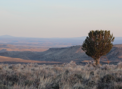
The western United States’ sagebrush country encompasses over 175 million acres of public and private lands. The sagebrush landscape provides many benefits to our rural economies and communities, and it serves as crucial habitat for a diversity of wildlife, including the iconic greater sage-grouse and over 350 other species.
Learn more about sagebrush steppe on the scale of the entire biome to evaluate sagebrush condition and prioritize areas for conservation investment. Now, in 2024, a special issue of Rangeland Ecology & Management brings together a suite of new research that leverages the SCD to answer big questions about sagebrush conservation. Learn all about this special issue at the Sagebrush Conservation Gateway.
Durability in conservation is a challenging thing. In the sagebrush sea, many restoration actions have temporary results, like spraying weeds, removing encroaching trees, or installing low-tech structures in creeks. In many cases, land managers will need to return to a site after a few years or decades and reseed the area with native plants, cut the trees that grew back in, or shore up the stream structures that naturally decayed. But there’s one action in sagebrush country that addresses one of the big threats to the sagebrush sea for good: conservation easements, specifically those in high-risk areas of cropland conversion.
Conservation easements are a broad category of voluntary, legal agreements between a private landowner and a land trust or qualified state or federal agency that limits certain uses or changes to a parcel of land. Many easements prevent land alterations in exchange for a financial amount. An easement can be tailored to the specific needs of a landowner or in other cases are standardized, and they commonly restrict land from being converted into row crop agriculture or other forms of development in perpetuity or for a set period of time.
Wildlife habitat loss is extensive when land is tilled under for agriculture, energy production, and road or structure structure
Something temporarily or permanently constructed, built, or placed; and constructed of natural or manufactured parts including, but not limited to, a building, shed, cabin, porch, bridge, walkway, stair steps, sign, landing, platform, dock, rack, fence, telecommunication device, antennae, fish cleaning table, satellite dish/mount, or well head.
Learn more about structure development. Across the American West, there has been a colossal loss of grassland and sagebrush landscapes to this practice. And there’s still much more that could be sod busted.
“When it’s gone, it’s gone,” said Geoff Bedrosian, a biologist for the U.S. Fish and Wildlife Service. “Easements as permanent protection are unique when confronting the threat of cropland conversion because they will 100% prevent that threat from occurring. In comparison to other conservation challenges, we are going to be fighting invasive annual grasses or conifer encroachment constantly due to the nature of that type of land health threat.”
Bedrosian is a particular type of modern scientist, a spatial modeling one, to be specific. This means he spends a lot of time virtually flying around the West via satellite imagery, teaching computer models to read the land and make certain predictions about what might happen. And what his models are showing is kind of scary.
“An area of sagebrush habitat the size of the state of Ohio has already been lost to cropland conversion,” he said. “Looking at what’s left, we see that more than 6 million acres of our high-quality sagebrush that’s still out there could potentially be tilled under.”
By combining maps of suitability for growing crops and overlaying them on private land with healthy existing sagebrush habitat, Bedrosian created a picture of the places with the most potential to be converted into cropland. Using a case study from north-central Montana, the research team demonstrated that private land easements indirectly preserve an area 3.6 times larger than the easements themselves due to their proximity to some of the most important sagebrush areas. Their model’s findings establish a direct connection between investments in private land conservation and beneficial outcomes on nearby public lands. This means that focused, permanent protection efforts can extend ecosystem health beyond property easement boundaries.
This mapping tool and the associated scientific journal article documenting it are part of a diverse partnership effort called the Sagebrush Conservation Design. Supported by the U.S. Fish and Wildlife Service and over twenty partnering organizations, the Sagebrush Conservation Design identifies the best remaining ecologically intact sagebrush areas and works to address landscape-level threats by supporting the strategic allocation of effort and resources. This partnership’s recent work focused on using the Sagebrush Conservation to deliver conservation on the ground, and Bedrosian’s research is part of this update.
“What our modeling shows is that there are a handful of unique landscapes where cropland conversion risk is most prevalent in sagebrush core areas,” he said. “So this means we now know where partners can support easements in key areas to enact permanent protections to save the best of what's left.” Partnerships are critical in this landscape, as various authorities and funding availability to agencies like the U.S. Fish and Wildlife Service can be limited. No one entity can take a “go it alone” approach in successful landscape-scale land protection efforts.
A key player in creating conservation easements in sagebrush country is The Nature Conservancy. Brian Martin is a co-author on this research with Bedrosian. Martin recently transitioned to a regional position in the Northern Great Plains with The Nature Conservancy after a long career in Montana working on some of the most extensive and contiguous sagebrush grasslands in the world there.
"These findings, and Sagebrush Conservation Design as a whole, provides a guide to prioritize limited funding to lands that have the greatest conservation benefits,” Martin said. “Geoff’s modeling helps us understand where we get the biggest return on investment when it comes to conservation easements. A single project can take years, so we have to know that we are working in the right location.” The U.S. Fish and Wildlife Service is spatially targeting conservation practices to prevent degradation of existing intact habitat and apply restoration where these efforts are most likely to succeed.
There is a lot of public land in Montana’s Phillips, Valley, and Blaine Counties. In that those public lands are not at risk for crop conversion, the modest footprint of private lands there are often exponentially important to conserve. For both Martin and Bedrosian, the use of spatial modeling to guide conservation investments is a great way to look at big regions, but on-the-ground context and community interests are critical when informing where conservation happens, especially with easements.
Martin said that this information can also help landowners to have perspective on how important their properties are in the large landscape around them. Even if they might not be interested in an easement today, they could be in the future. At some point, they might be thinking about transitioning the ranch to the next generation or seeking a retirement option and an easement may be a tool that makes those plans possible.
“I have had conversations with multiple landowners over the years that were never going to consider an easement on their property but ultimately have done so,” he said. “Spending time and listening to a family's needs, whether it's an easement or not, is key to being a good partner and creating the space for owners to potentially circle back to easements in the future.”
Thinking back on his conservation career, Martin shared that he feels that the health of the landscape is predicated on the investment of the people that live there.
“A lot of the joy in conservation is working with people that are passionate about the place where they live and want to steward the land for future generations,” he said. “If you’re doing well for the land, it’s good for people, too. Sustainable landscapes make sustainable communities."
Much in the same vein, Bedrosian reflected on his professional and personal perspective on how the Sagebrush Conservation Design information is about large-scale prioritization as well as an individual’s value for natural resources.
“Frankly, as a scientist, I want my work to matter. And this science shows us the places where we know it will matter most to protect,” Bedrosian said. “Even though I sit in an office in Denver that’s quite far from the places we're talking about here, I'm really motivated by the opportunity to help make changes in conservation that matter. This biome is the last, largest, most intact landscape in the lower 48. In our lifetime, we have the opportunity to protect and preserve that so that it's not lost to future generations.”
If you would like to read the full journal article documenting Bedrosian’s findings, please see “Modeling cropland conversion risk to scale-up averted loss of core sagebrush rangelands” in the November 2024 issue of Rangeland Ecology & Management and visit www.sagebrushconservation.org to access the other journal articles supporting the most recent updates to the Sagebrush Conservation Design effort.


