Photo By/Credit
Pulikla Tribe of Yurok People/Pulikla Tribe of Yurok People
Date Shot/Created
03/14/1965Media Usage Rights/License
Public Domain
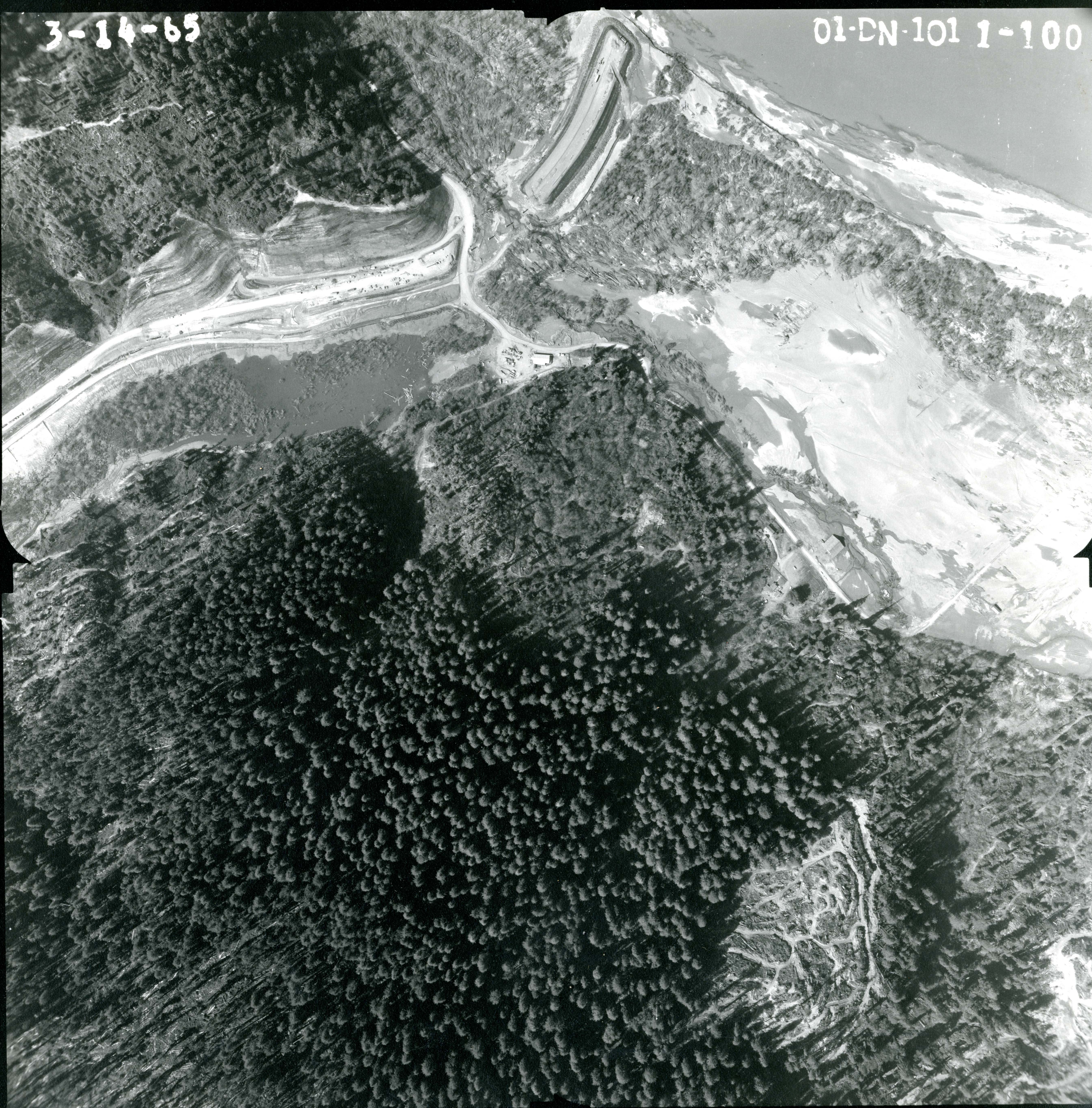
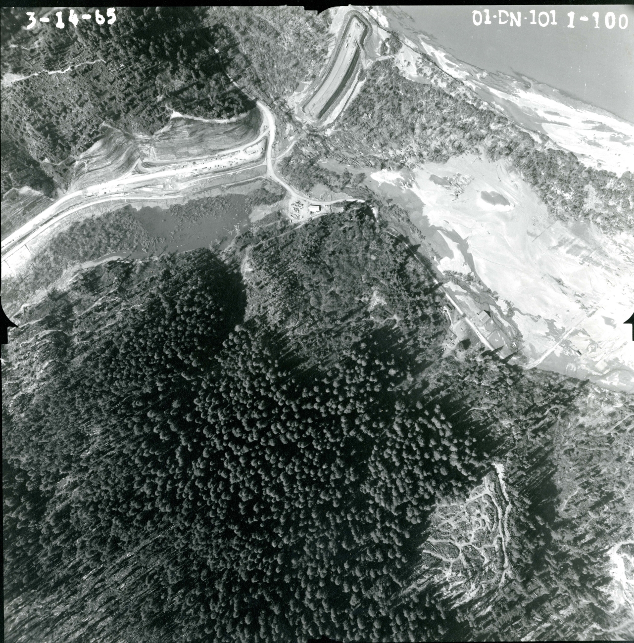
Image
Aerial photo showing the devastation three months after the historic flood event of December, 1964. The community of the Pulikla Tribe of Yurok People (formerly the Resighini Rancheria, bare land on right) was completely destroyed, along with the Highway 101 bridge across the Klamath River (top center.)
Partner(s)
Ecosystem
Coastal
Forest
River/stream