Photo By/Credit
USFWS
Date Shot/Created
09/26/2024Media Usage Rights/License
Public Domain
Image
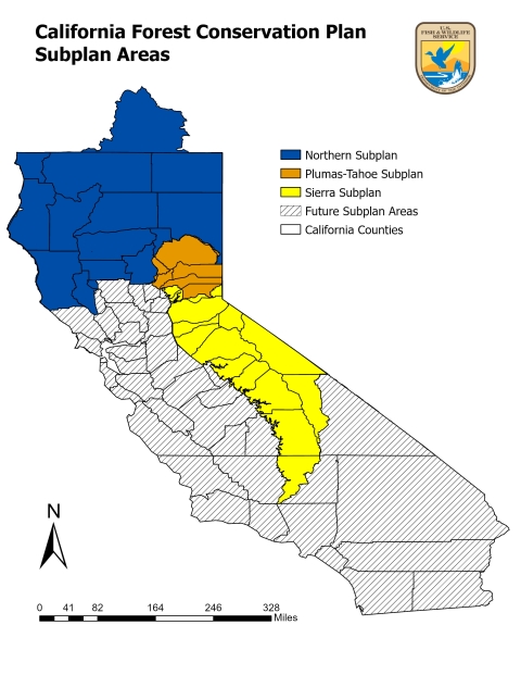
A map showing the subplan areas of the California Forest Conservation Plan. This map shows California and the Klamath Basin in Oregon. The map is broken out into four areas. One region, called the Northern Subplan, is shaded in blue and encompasses the Klamath Basin in Oregon plus 12 California counties, including Del Norte, Humboldt, Mendocino, Lake, Colusa, Glenn, Tehama, Shasta, Siskiyou, Modoc, and Lassen. An orange shaded area is called the Plumas-Tahoe Subplan and includes Plumas, Butte, Sierra, Yuba, and Nevada counties. A yellow shaded area is called the Sierra Subplan and includes Eldorado, Alpine, Amador, Calaveras, Tuolumne, Mono, Mariposa, Madera, Fresno, Inyo, Tulare, and Kern counties. The rest of California is shaded in gray.
Partner(s)
