Skip to main content
U.S. Fish & Wildlife Service
Toggle navigation
Utility (Top) navigation
About Us
Forward
Back
About Us
Mission & Vision
Leadership
Our Organization
Our Facilities
Regions
Laws & Regulations
Forward
Back
Laws & Regulations
Laws, Agreements & Treaties
Hunting Regulations
FWS Federal Register Documents
Library
Forward
Back
Library
Categories
Collections
Home
Services
Forward
Back
Services
Duck Stamps
Forward
Back
Duck Stamps
Buy a Duck Stamp or E-Stamp
Buy a Junior Duck Stamp
State Agencies Apply to E-Stamp
Fish Stocking
Importing & Exporting
Consultation & Technical Assistance
Forward
Back
Consultation & Technical Assistance
ESA Section 7 Consultation
Habitat Conservation Planning (HCPs)
Candidate Conservation Agreements
Conservation Banking
Conservation Benefit Agreements
Coastal Barrier Resources Act Project Consultation
Coastal Barrier Resources System Property Documentation
Financial Assistance
Species Management
Investigational New Animal Drugs (INADS)
Permits
Search All Services
Duck Stamps
One of the easiest ways that anyone can support bird habitat conservation is by buying duck stamps.
Species
Forward
Back
Species
Explore Taxonomic Tree
Find a Species
Interest story
Bats: “The Coolest Mammals on Earth”
Visit Us
Forward
Back
Visit Us
Events
National Fish Hatcheries
National Wildlife Refuges
Outdoor Recreation
Recreation Passes
Locations
Scenic Drives
Tour routes of great scenic drives on National Wildlife Refuges.
Get Involved
Forward
Back
Get Involved
Careers and Internships
Volunteering
Friends Partnerships
Learning Opportunities
Education Programs
Events
Partnerships
Forward
Back
Partnerships
Partnership Categories
Partner List
Volunteer
Search for volunteer opportunities around the country
Newsroom
Forward
Back
Newsroom
Press Releases
Congressional Testimony
Media Contacts
Wild Things
News about wonderful wild things and places
Initiatives
Forward
Back
Initiatives
Combating Wildlife Trafficking
Director's Priorities
Climate Change
Fishing
Invasive Species
Pollinators
Protecting Wildlife
Protecting Wildlife
Working with others to conserve, protect, and enhance fish, wildlife, plants, and their habitats.
I want to
Forward
Back
I Want To
Report Wildlife Crime
Do Business with FWS
Volunteer
Find a Job or Internship
Visit a Refuge
Buy a Duck Stamp
Apply for a Permit
Find Funding
Find Training
Wild work
Search employment opportunities with USFWS
Search
Search
Search
Enter the terms you wish to search for.
×
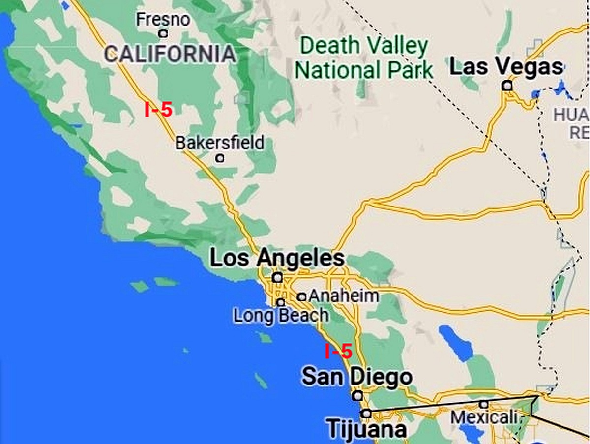
Map of the southern California portion of Interstate 5
Photo By/Credit
Google Maps
Copy Credit
Date Shot/Created
02/01/2022
Media Usage Rights/License
Creative Commons Attribution-NonCommercial 4.0
Image
This is for use with "The Wildlife Refuges of I-5" story.