
Location


States
LouisianaEcosystem
Coastal, WetlandIntroduction

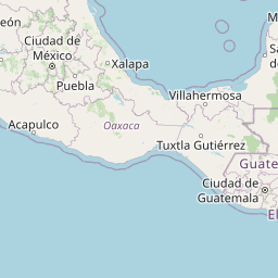
The Pointe-au-Chien Indian Tribe (PACIT) is a state-recognized Native American Tribe in the Terrebonne and Lafourche Parishes of Louisiana. The Tribe consists of approximately 800 members and is positioned along the Bayou Pointe-au-Chien. Due to climate change climate change
Climate change includes both global warming driven by human-induced emissions of greenhouse gases and the resulting large-scale shifts in weather patterns. Though there have been previous periods of climatic change, since the mid-20th century humans have had an unprecedented impact on Earth's climate system and caused change on a global scale.
Learn more about climate change , this area in coastal Louisiana experiences one of the highest global rates of sea level rise. Increased sea level rise is exacerbating land loss due to subsidence (the gradual sinking of land), marsh fragmentation, and increased erosion from storm impacts, salt water intrusion, and local oil and gas extraction sites.
The PACIT has deep, place-based knowledge of coastal Louisiana passed down through many generations. This knowledge, also known as traditional ecological knowledge (TEK), has accumulated through direct observation and connection with their ancestral homeland. The PACIT has used TEK as a guidepost for their interdependent relationship with local ecology and adaptation to environmental changes throughout time. However, previous generations have never experienced such rapid rates of climate change.
To increase their capacity to make informed adaptation decisions, the PACIT is collaborating with Louisiana Sea Grant (LSG) researchers and other external partners to combine Western scientific data and TEK to support their understanding of urgent climate change vulnerabilities in coastal Louisiana. This partnership helped the PACIT communicate their priorities and needs with external organizations through collaboration on GIS-generated maps illustrating current and predicted climate change impacts to the area. These maps will aid the prioritization of short- and long-term PACIT-led mitigation and adaptation strategies.
Key Issues Addressed
Two-Sided Impact: While oil and gas extraction sites may negatively affect the environment, the industry also stimulates the local economy and supplies jobs for Tribal members.
Adaptation capacity is strained due to current climate change rates. The PACIT wants to maintain a connection with their homeland, but many have been forced to relocate as wetlands in coastal Louisiana deteriorate due to accelerated climate change impacts (e.g. subsidence, sea-level rise, saltwater intrusion, and exacerbated storm surges) affecting local fishing resources, sacred sites, and their homes. Furthermore, oil and gas companies created a network of canals and spoil banks to access extraction sites in the marshes surrounding Pointe au Chien. Over time, these canals have widened due to erosion and increased saltwater intrusion in this area which exacerbates land loss. By mapping spoil bank density and land loss, the PACIT can use the maps to identify priority areas for land conservation and TEK-based planning.
The PACIT does not have a formal climate change mitigation plan or tools at relevant scales to identify prominent risks. The extent of current and future climate-related issues impacting the PACIT and their ecosystems was primarily undocumented before this project. The decision-makers within PACIT have looked to Western science approaches, such as mapping and planning tools as an adaptation strategy to augment their TEK in planning for climate change impacts. Including the PACIT’s TEK into these tools will create relatable models that project future ecosystem impacts at relevant scales. Combining these different ways of knowing is crucial for generating plans that prioritize high-priority risks from the Tribe’s perspective.
To successfully include TEK with science-based decision making approaches and broaden mitigation and adaptation options, Indigenous Tribes and Western scientists need to build respectful relationships. The PACIT’s ancestry was incorrectly documented by anthropologists in the twentieth century, and this mislabel led to the Tribe’s inability to receive federal recognition. Indigenous Tribes are often misled by Western scientists in ways similar to the PACIT’s experience. Western research used inappropriate methods and assumptions while engaging with the PACIT, leading to gaps between TEK and Western data. Combining data from multiple ways of knowing would give the PACIT increased access to relevant decision-making tools, as well as demonstrate how the multi-generational, place-based relationship PACIT has to this land can be woven with science to support adaptation planning processes.
Project Goals
- Understand and record the current and future climate-related issues impacting the interdependent relationship between the PACIT and their ecosystem
- Develop knowledge convergence processes to organize quantitative Western data on current and future climate change impacts with qualitative TEK data on PACIT areas of concern
- Utilize GIS mapping to create a decision-support tool that visualizes perceived and actual vulnerabilities and opportunities for mitigation
- Build trust and create meaningful relationships between researchers and the PACIT through the engagement necessary to develop the decision-making tool
Project Highlights
- Qualitative Data Collection: TEK data collection included multiple phases to ensure thorough documentation of climate-related issues impacting the PACIT. The whole process began with listening, and the map products were developed to represent knowledge shared through the project. First, the Tribal Council selected four TEK experts based on their relevant climate change impacts expertise. Four field-based interviews were held with these TEK experts, where LSG partners toured areas of cultural importance and perceived risk. Next, researchers hosted focus groups to identify the Tribe’s climate change concerns and potential response plans. Using the initial data collection, researchers created maps to support additional input and gather follow-up questions from the PACIT.
- Organizing Data: Scientists reviewed information from data collection and identified repeated concepts voiced by the PACIT, as well as documented current and future climate impacts. To organize this data, concepts were simplified into codes based on whether they affected the vulnerability or sustainability of the Tribe. Vulnerability was assessed by exposure to coastal hazards and their driving factors. Sustainability was assessed based on areas or features of the ecosystem that PACIT members believed had the capacity to mitigate climate change impacts. These codes were classified on a scale from 0 to 3 based on climate change data and PACIT urgency.
- Generating Maps: Researchers generated maps to display selected vulnerability factors, such as land loss or spoil bank density. Then, researchers combined these maps into a composite map to identify relative areas that contribute to both the PACIT’s vulnerability to climate change impacts as well as sustainability and resilience to those impacts. Researchers used two-digit numbers to identify the relative impact of these vulnerability and sustainability factors in specific areas. These maps allowed the PACIT to easily identify locations where climate change impacts need to be addressed first such as the widening of oil canals or the density of spoil banks.
- Respectful Relationship Dynamics: Researchers emphasized respect for the PACIT, their knowledge, and their culturebefore the initiation of the project and during each step of the process. The lead researcher has worked alongside the PACIT for 15 years. LSG was also open to establishing data sharing and research protocol agreements to protect PACIT information, both of which supported communication and trust. The field interviews and focus groups emphasized organic relationship-building between researchers and the PACIT.
Lessons Learned

Consistent communication with all PACIT interview members during each step of the mapping exercise resulted in project outcomes that were easily understood and meaningful to PACIT's needs. Without this, there could have been gaps in goals the PACIT needed to address, or they may not have understood all of the maps. LSG researchers displayed the maps to the PACIT before finalizing them so the PACIT could supply additional input if necessary. By furthering communication on map themes, researchers effectively demonstrated potential negative side effects of sustainability-coded actions due to projected sea level rise, such as the decreasing efficacy of spoil banks as sea levels rise to act as speed bumps for storm surges by disrupting the wave before it reaches PACIT structures.
The likelihood of a successful project increases by fostering a relationship through mutual engagement and respect, rather than basing it on transactional interactions. Contributors got to know the PACIT through dinners and meeting the families of those directly involved in the project. When partnering with Tribal governments it is important to note that most do not have large departments to facilitate an influx of requests from external partners. This influx is often caused by the recent prioritization of historically underserved Tribes in grant funding. When looking to work with Tribes, it is crucial to facilitate a mutually beneficial relationship before introducing ideas for resiliency projects based on grant funding.
Some of the Indigenous Tribes’ TEK is sensitive data because it is unique to their identities and captures the Tribe’s way of life, such as their morals or land use practices. Setting boundaries and legal conditions for data rights agreements was important for this partnership. By setting this expectation early, LSG was able to avoid crossing boundaries concerning what can be shared publicly and what can not.
Next Steps
- The PACIT will use the “Drowned Spoil at Projected Sea Level Rise,”, “Pointe Aux Chenes Study Area Sustainability-Vulnerability Combination,”, “Pointe Aux Chenes Study Area Land Loss Density,”, and “Pointe Aux Chenes Study Area Spoil Bank Density” maps to identify critical climate change vulnerability factors
- Utilize the visualizations of the combined data and vulnerability factors to inform short and long-term mitigation planning
- The PACIT will also use the generated maps to clearly communicate urgent risks when requesting funding and aid from state and federal agencies
Funding Partners
- Louisiana Sea Grant College Program
- National Oceanic and Atmospheric Administration - Gulf of America Coastal Storms Protection
- Mississippi-Alabama Sea Grant Consortium
Resources
Bethel et al. (2022). “Mapping risk factors to climate change impacts using traditional ecological knowledge to support adaptation planning with a Native American Tribe in Louisiana.” Journal of Environmental Management 301
Contacts
Matthew Bethel, Louisiana Sea Grant: mbethe3@lsu.edu
CART Lead Author
Haylee Kraker, CART Student Writer, University of Oklahoma
Suggested Citation
Kraker, H., J. and Jewell, K., D. (2024). “Mapping Climate Change Impacts and Traditional Ecological Knowledge for Potential Mitigation and Adaptation Strategies.” CART. Retrieved from https://www.fws.gov/project/climate-change-impacts-traditional-ecological-knowledge.


