Location


States
New MexicoEcosystem
MontaneIntroduction
The Rio Grande provides water resources to over 13 million people across Colorado, New Mexico, Texas, and parts of Northern Mexico. Approximately 75% of the Rio Grande’s water supply is provided by snowmelt from late spring to early summer. Climate change, bark beetles, and wildfires are causing forest disturbances. These disturbances result in changes to the quantity and timing of snow and snow melt processes, which is impacting the amount of snow water resources available to users across the Rio Grande Basin.
Canopy density, a measure of the forest canopy density, has been the primary characteristic used to represent canopy structure structure
Something temporarily or permanently constructed, built, or placed; and constructed of natural or manufactured parts including, but not limited to, a building, shed, cabin, porch, bridge, walkway, stair steps, sign, landing, platform, dock, rack, fence, telecommunication device, antennae, fish cleaning table, satellite dish/mount, or well head.
Learn more about structure in snow water resource models (Moeser et al., 2024). However, recent research from the U.S. Geological Survey (USGS) found that canopy structure, which includes forest gaps and canopy edges, is an important characteristic in forest-snow interactions. Thus, USGS is currently developing novel methods for integrating canopy structure into snow water resource models (Moeser et al., 2024).
The quantity and timing of snowmelt are projected to change due to climate change climate change
Climate change includes both global warming driven by human-induced emissions of greenhouse gases and the resulting large-scale shifts in weather patterns. Though there have been previous periods of climatic change, since the mid-20th century humans have had an unprecedented impact on Earth's climate system and caused change on a global scale.
Learn more about climate change ’s impact on forest-snow interactions. A warmer climate is projected to increase the severity of wildfires and bark beetle infestations. Forests are key determinants to water supply and quality, and these forest disturbances are expected to decrease the amount of snow water resources (Moeser, 2017). To date, snow water resource models have struggled to accurately model the supply of snow water equivalence (SWE), a measure of how much water exists within snowfall, after a forest disturbance.
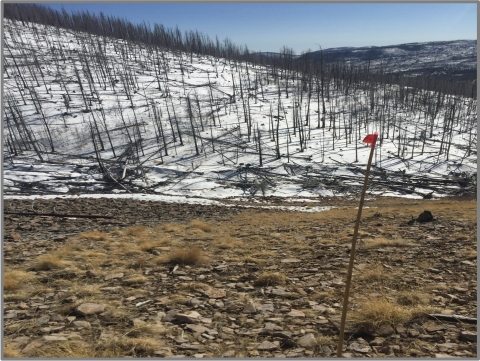
To understand the relationship between forest structure and water supply, researchers at the USGS developed a snow water resource model that pairs the Snow Physics and Lidar Mapping model (SnowPALM) with high resolution light detection and ranging (LIDAR) datasets to quantify the impact of the 2011 Las Conchas Fire in New Mexico on local snow water resources (Moeser, 2017). SnowPALM has enabled USGS researchers to improve the understanding of forest-snow interactions in existing snow water models, demonstrating how future snow water models might improve their forest-snow representations and accuracy. Additionally, land managers may be able to use such a model to project changes in snow water resources throughout the year to inform planning, assessments, and decision-making.
Key Issues Addressed
The amount of land burned by wildfires across the Rio Grande Basin is projected to increase by 300% to 700% with a 1°C increase in global average temperatures (Moeser et al., 2024). Snow water resource models have been unable to model the impact of these forest disturbances on snow water resources due to the inaccurate representations of canopy structure.
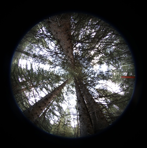
Canopy density alone does not represent forest environments. Without accurate representations of canopy structure, models cannot capture the full impact of forest disturbances on snow water resources under multiple climate conditions. As a result, there is a need to integrate additional canopy characteristics, such as forest gaps and edges, into snow water resource models.
Until recently, models have lacked the ability to accurately quantify the relationship between changes in forests, and changes in snow quantity and retention time. Additionally, there have been no modeling platforms or studies that have characterized or quantified the effects of these forest disturbances on snow-water resources under multiple climate conditions (Moeser, 2017).
Better understanding the relationship between forest disturbance and snow water resources increases researchers’ abilities to project potential changes in snow water resources, which can be used to inform resource management decisions. However, land managers lack models that accurately reflect the impacts of climate change as well as current and future forest disturbances across the Rio Grande on snow water resources to support decision making, planning, and assessments.
Project Goals
- Improve the representation of forest canopy structure characteristics, including forest gaps and edges in snow water resource modeling to better represent the impact of forest disturbances on snow water resources
- Use SnowPALM with pre- and post- LIDAR data from the 2011 Las Conchas Fire to quantify the impacts of forest disturbances on local snow water resources under multiple climate conditions
- Utilize model results to support land managers and researchers engaged in decision-making and analysis of forest disturbances on snow water resources at relevant scales
Project Highlights
Estimating Variation: USGS researchers have shown 40-70% of snow water equivalent variation in forested environments can be estimated using shortwave radiation and canopy structure, metrics that indirectly account for terrain and canopy shading.
- Improved Snow Water Resource Modeling: Researchers created two models using an updated version of SnowPALM and available LIDAR data to represent the 2011 Las Conchas burn area, which included generalized canopy structure classes, such as forest gaps, edges, and the interior forest. Researchers focused on locations with decreasing peak SWE and melt-out dates and used the generalized canopy structure classes to describe relative forest locations where reductions in peak SWE and melt out date would likely be seen again. This is one of the first models to accurately relate forest disturbances to changes in snow.
- Post-Forest Disturbance Characteristics: The shape of forest gaps relative to aspect was as important, if not more important than the size of canopy gaps for representing post-disturbance changes in snow water resources. Locations of the forests that transitioned to south-facing canopy edges after a forest disturbance had the largest decreases in SWE and melt out dates. Additionally, large decreases were also found in locations that were originally small canopy gaps that transitioned to larger canopy gaps with a southerly aspect.
- Post-Forest Disturbance Changes: Changes in peak SWE and melt-out date post-fire varied. Relative to pre-fire conditions, the post-fire peak SWE and melt-out date, for all years, were nearly always higher and later for the entire field area. However, approximately one third of the area showed substantial decreases in post-fire peak SWE and earlier melt-out dates. These collective results mirror field observations that document both increases and decreases in snow water and differ from most other modeling studies that have shown only increases in SWE after a forest disturbance.
- Informing Future Decision Making: The relationships between interior forests, canopy gaps, and canopy edges with respect to changes in peak SWE and melt-out date can be used to qualitatively assess the impacts of canopy disturbances on snow water resources at a larger scale in the region. Understanding these relationships can inform specific thinning techniques such as minimizing the amount of south-facing edges, avoiding increases in forest gaps to the south, and thinning smaller trees rather than larger ones. This could lead to maximizing snow retention time in geographically similar watersheds.
Lessons Learned
By using SnowPALM, researchers determined that forests do not need complex representations in snow water resource models. However, spatial components of forests such as forest edges and gaps should be represented. Using these results, researchers determined canopy density alone does not adequately relate forest disturbances to changes in peak SWE, especially if modeling over coarser, larger domains (Moeser et al., 2024).
Researchers built this model using high resolution pre- and post- forest disturbance LIDAR data to represent the 2011 Las Conchas Fire. However, high resolution LIDAR data is not widely available throughout the Rio Grande Basin, which can make recreating forest representations in areas with less data challenging. This presents an additional challenge when trying to model the impact of forest disturbances on snow water resources at coarser resolutions.
Additionally, researchers found that forest disturbances that cause an increase in the size of south facing canopy edges or gaps can greatly reduce the amount of snow water resources and contribute to earlier melt-out dates. This highlights that locations no longer shaded by overlying forest and have neighboring south facing canopy gaps can increase heat, which leads to increased snowmelt. This result is especially impactful for forested regions that are more sensitive to subtle shifts in the sub-canopy energy balance and climate changes such as the Rio Grande basin and other low-latitude, snow-dominated forests.
This project did not account for temporary increases in woody debris, ash, and black carbon falling on the surface of the snow. These variables can increase the rate of snowmelt throughout the burn area and beyond the fire’s original footprint. More research is needed to better integrate and quantify temporally changing albedo conditions after forest disturbances.
Next Steps
- Researchers are currently developing a coarse-scale model that can be run over a large regional scale that includes canopy structure and can represent forest disturbance without multiple LIDAR based representations (Moeser et al., 2024).
- Develop a decision support tool that will integrate climate data and stakeholder defined scenarios to model changes in snow water resources under multiple climate conditions and after a forest disturbance.
- Utilize improved canopy structure representations to better understand the impact of forest disturbances on base flow, which are water resources that sustain streamflow through periods without precipitation.
Funding Partners
- South Central Climate Adaptation Science Center
- U.S. Geological Survey Southwest Region
- New Mexico Water Science Center
Resources
- Moeser et al. (2024). “Modeling Forest Snow Using Relative Canopy Structure Metrics.” Water 16:10
- Github repository for SnowPalm
- Moeser. C. D., (2017) “Final Report: The effects of wildfire on snow water resources under multiple climate conditions.”
Contacts
C. David Moeser. U.S. Geological Survey: cmoeser@usgs.gov
CART Lead Author
Liam Thompson, CART Student Writer, University of Oklahoma
Suggested Citation
Thompson, L. C., Moeser, C. D., (2024). “The Effects of Wildfire on Snow Water Resources Under Multiple Climate Conditions.” CART. Retrieved from https://www.fws.gov/project/effects-wildfire-snow-water-resources-under-multiple-climate-conditions.


