As part of the National Wetlands Inventory, we are mapping and digitizing high priority wetlands in Alaska’s 16 National Wildlife Refuges.
The U.S. Fish and Wildlife Service is the principal federal agency tasked with providing public information on the status and trends of our Nation's wetlands. Our National Wetlands Inventory provides detailed information on the abundance, characteristics, and distribution of U.S. wetlands.
Alaska is in a unique situation when it comes to statewide mapping initiatives. The Alaska Mapping Executive Committee and the Alaska Geospatial Council have facilitated numerous opportunities for agencies and organizations to partner across the vast state to accomplish common mapping objectives. We're working closely with partners, particularly the Bureau of Land Management, to co-map entire regions of the state.
National Wildlife Refuge Mapping Status in Alaska
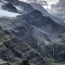
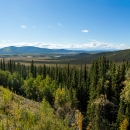
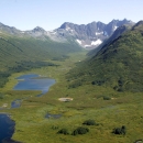
Arctic: Project plans to complete the entire Arctic refuge are in place. The 1002 area will be completed first and then the remainder of the refuge. The coastal plain is characterized by broad palustrine scrub-shrub wetland complexes underlain by deep continuous permafrost. The southern portion of the refuge includes broad systems of multi-channeled rivers, groundwater fed systems and large lakes. All field work for the Arctic Refuge work has been complete.
Alaska Maritime: Completing the inventory of Alaska Maritime National Wildlife Refuge may be our largest challenge, as geographically, it spans the largest distances of any refuge. At this time, much of the Aleutian Islands are unmapped and we do not have plans in place for mapping yet. However, there are about 500,000 acres of mapping occurring, mainly in southcentral Alaska.
Alaska Peninsula and Becharof: About 1.6 million acres of Alaska Peninsula began in 2021 and field work is scheduled to occur in 2022. This mapping project includes concurrent creation of the National Hydrography Data.
Innoko: All of Innoko National Wildlife Refuge is under contract or agreement to be mapped. This project is being completed as part of a broader “Western Alaska” National Wetlands Inventory project that includes Yukon Delta National Wildlife Refuge and lands that lie between the two refuges. We are hopefully field work can occur in 2022.
Kanuti: All of Kanuti National Wildlife Refuge is under contract or agreements to have complete inventory coverage. It's a mix of multiple Bureau of Land Management projects and the Service's Kanuti-Yukon Flats project which was developed to complete the inventory across those two refuges.
Kodiak: All of Kodiak and Afognak Islands are scheduled to have complete inventory coverage through an award from the Exon Valdez Oil Spill Trustee Council. They will also have updated concurrently developed National Hydrography Data. Field work for this project is scheduled for Summer 2022.
Kenai: The Kenai refuge is one of the few refuges with complete legacy inventory coverage (from the 1970s and 80s). The southern portion of Kenai (approximately 1.4 million acres) is scheduled to receive an inventory update through an award from the Exon Valdez Oil Spill Trustee Council. This project is in its infancy and we expect it to be completed around 2025.
Koyukuk and Nowitna: All of Koyukuk and Nowitna refuges are under contract for completion along with nearby Bureau of Land Management lands. This was designed so we could have regionally consistent mapping.
Selawik: A wetlands inventory was completed for Selawik in 2019.
Tetlin: Tetlin National Wildlife Refuge has quite a bit of legacy inventory data, but there were some gaps. We just initiated the Tetlin-Eastern Alaska project to complete coverage across Tetlin refuge. Once complete, we will be able to evaluate how the different mapping conventions over the years have resulted in generally similar, or different, data.
Togiak: Togiak National Wildlife Refuge has about 530,000 acres of mapping occurring through a variety of projects (the refuge is over 4.4 million acres). These include Bureau of Land Management projects along the boundary, the southern extents of the Western Alaska and Lower Kuskokwim projects. The Lower Kuskokwim project is scheduled to be complete in early 2022.
Yukon Delta: Yukon Delta is under agreement to complete inventory coverage across more than 23 million acres. This is through two projects, the Lower Kuskokwim which is scheduled to be complete in early 2022 and The western Alaska project which is scheduled to be complete in 2024.
Yukon Flats: The inventory of Yukon Flats National Wildlife Refuge is in progress and will have complete inventory coverage. Currently, there are two Bureau of Land Management projects with active mapping along edges of the refuge and the Service's Kanuti-Yukon Flats project covering the remaining 3.4 million acres of the refuge that does not have existing National Wetlands Inventory coverage.