Management and Conservation
Wildlife and Habitat Management
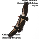
Since 1995, the refuge has served as a release site for the California Condor Recovery Program to release condors into the wild. Condor management activities include:
- Condor population monitoring; very high frequency (30–300MHz) (VHF), global positioning system (GPS), and visually providing sites for the Recovery Program to trap and process condors (assess body condition, attach transmitters).
- Twice yearly (minimum) trapping and sampling all southern California condors; monitoring contaminants in released condors (analyzing blood and feather samples).
- Providing sites to vaccinate condors for West Nile Virus and sites for supplemental feedings to maximize survivorship.
- Maintaining temporary quarters for Service biologists performing Recovery Program activities and researchers, volunteers, and partners supporting Recovery Program or refuge goals.
- Releasing up to 15 tagged condors into the wild per year (as needed and as determined by the Recovery Program).
- Coordinating with ranches to allow condors to feed on natural livestock mortalities.
The Service also manages grassland, mixed scrub, oak and juniper woodlands, riparian riparian
Definition of riparian habitat or riparian areas.
Learn more about riparian , and wetland habitats that support other plants and wildlife, as well as the condor.
Wildlife Surveys
To date, plant and wildlife data collected to inform refuge management decisions include surveys for burrowing owl (Athene cunicularia) (2006), rare and endangered reptiles and amphibians (1994), small mammals (2006–2007), tricolored blackbird (Agelaius tricolor) (2006–2011), and plant surveys of Bitter Creek NWR (1997, 2009–2011). Sightings of wildlife have also been documented for San Joaquin kit fox (Vulpes macrotis mutica) (1982–2009), tule elk (Cervus elaphus ssp. nannodes) (2008–present), and other species (periodically between 1991 and 2008).
See Appendix D of the CCP for a list of surveys conducted.
Fire Management
Fire preparedness is an important aspect of refuge management. The Service suppresses all wildfires and implements fire prevention and mitigation measures (such as fuel breaks) at the wildland-urban interface (WUI) and roads. The approved update to the Fire Management Plan for Bitter Creek NWR allows prescribed burning in the form of pile burning (USFWS 2001). Pile burning is a low risk use of fire, used primarily in winter, when air quality is less likely to be adversely affected. The Service obtains the required permits to burn from the regional air quality district. Department of the Interior and Service policy require that the Service comply with all air quality regulations and obtain permits for all planned burning on the refuge.
For more information on the FWS Fire crew that is responsible for this refuge, please visit the Fire Management Page.
Cultural Resources Management
Previous cultural resource inventories have recorded sites associated with Native American use of the refuge area along with historic-period resources. To date, approximately 7.5% (1,886 acres) of the 14,096-acre refuge has been systematically surveyed as a result of 13 archaeological research projects conducted on the refuge. It is highly probable that additional archaeological sites will be exposed by human actions or natural causes in the future. Previous archaeological research includes the following. In 1982 and 1983, three land parcels were surveyed for cultural resources in anticipation of development for housing within or immediately adjacent to what later became the refuge boundary. As a result, seven prehistoric archaeological resources and three isolated artifacts were recorded within the current refuge boundaries.
Archaeological fieldwork on the refuge since its establishment in 1985 has primarily focused on compliance with Section 106 of the NHPA for a variety of undertakings proposed either by right-of way holders or by the refuge.
Conservation
Current Status
The planning process for Hopper Mountain, Bitter Creek, and Blue Ridge National Wildlife Refuges’ Comprehensive Conservation Plan and Environmental Assessment (CCP/EA) is now complete. The Final CCP/EA is available below. The Final CCP outlines the management direction and strategies for the three refuges for the next 15 years.
Refuge Planning
National Wildlife Refuge planning sets the broad vision for refuge management and the goals, objectives, strategies, and actions required to achieve it. Planning ensures that each refuge meets its individual purposes, contributes to the Refuge System’s mission and priorities, is consistent with other applicable laws and policies, and enhances conservation benefits beyond refuge boundaries.
Comprehensive Conservation Plans
Comprehensive Conservation Plans (CCPs) are the primary planning documents for National Wildlife Refuges. As outlined in the National Wildlife Refuge System Administration Act, as amended, the U.S. Fish and Wildlife Service (Service) is required to develop CCPs that guide refuge management for the next 15 years. CCPs articulate the Service’s contributions to meeting refuge purposes and the National Wildlife Refuge System mission. CCPs serve as a bridge between broad, landscape-level plans developed by other agencies and stakeholders and the more detailed step-downs that stem from Refuge CCPs.
The 2013 Final Comprehensive Conservation Plan for Hopper Mountain, Bitter Creek, and Blue Ridge National Wildlife Refuges can be found here: https://ecos.fws.gov/ServCat/Reference/Profile/43995
Step-down Plans
CCP step-down plans guide refuge-level programs for: (1) conserving natural resources (e.g., fish, wildlife, plants, and the ecosystems they depend on for habitat); (2) stewarding other special values of the refuge (e.g., cultural or archeological resources, wilderness, wild and scenic rivers, etc.); and (3) engaging visitors and the community in conservation, including providing opportunities for wildlife-dependent recreation. Like CCPs, step-down plans contribute to the implementation of relevant landscape plans by developing SMART (Specific, Measurable, Achievable, Relevant, and Time-bound) objectives, strategies, implementation schedules, and decision support tools to fulfill refuge visions and goals. This ensures that refuges are managed in a landscape context and that conservation benefits extend beyond refuge boundaries.
Project Contacts:
Refuge Manager
Hopper Mountain National Wildlife Refuge Complex
2493 Portola Rd, Suite A, Ventura, CA 93005
Phone: (805) 644-5185
Fax: (805) 644-1732
Law Enforcement
The National Wildlife Refuge System's Law Enforcement Division is responsible for physical security and emergency management on FWS lands. Refuge law enforcement officers have federal jurisdiction to enforce all federal laws throughout the United States.


