About Us
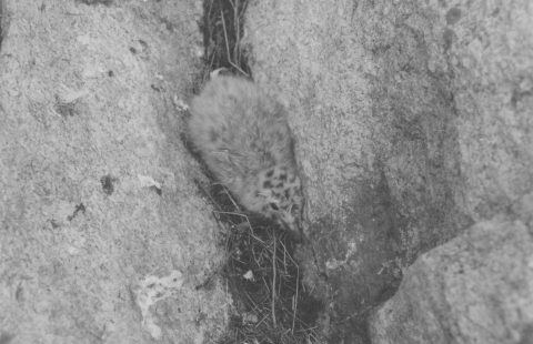
Eight small islands, totaling 147 acres, make up Huron National Wildlife Refuge. The refuge is located just three miles off the south shore of Lake Superior in Marquette County, Michigan. The refuge was established in 1905 as a refuge and breeding ground for migratory birds and other wildlife, especially the herring gull, which had large nesting colonies on the islands. These early bird sanctuaries were vital for several species of birds, including the herring gull, whose populations had been drastically reduced by plume hunters and egg collectors in the 1800s and early 1900s. All islands are closed to the public except for Lighthouse Island.
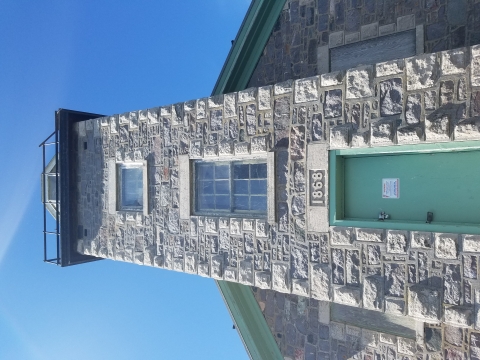
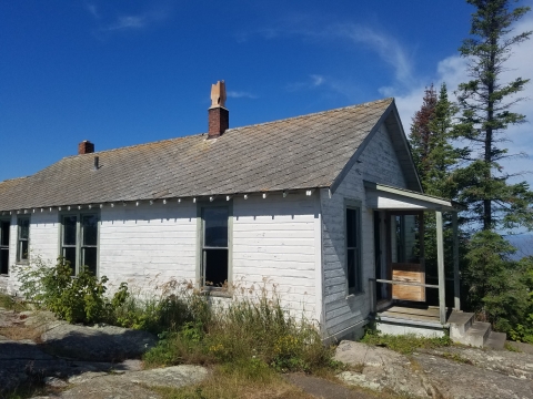
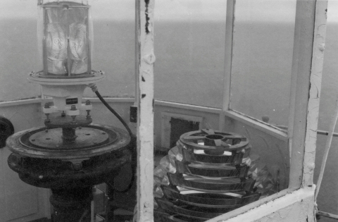
Lighthouse Island is the second largest island at 40-acres and the only one open to the public. In 1868, a lighthouse was built on the island to aid in navigation, and in 1972, the light was automated eliminating the need for a manned station. Today, the lighthouse is listed on the National Register of Historic Places.
McIntyre Island is the largest of the islands at 77 acres and supports the most diverse habitats. Cattle Island (12 acres) and Gull Rock (15 acres) were the sites of large herring gull colonies. The four largest islands all support some boreal forest. In addition, McIntyre Island has a few small patches of sphagnum bog. The remaining four islands make up only three acres and are little more than granite outcroppings. While the nameless bare rock islands are small, rising just 10-50 feet out of the water, Lighthouse and McIntyre Islands rise 160 feet above Lake Superior. There are no permanent streams on any of the islands, but there are a few calderas on the largest islands that collect and hold rainwater.
The granite upthrusts that make up the islands are billions of years old. Covered in glaciers during the last ice age, the islands would have been little more than bare rocks and thin soils when the glaciers retreated. Scars, or glacial striations, left by glaciers as they pushed rocks are still plainly seen embedded in the bedrock of the islands. The plants and animals inhabiting the islands have found their way there over the last 9,000 years.
Due to the remote nature and primitive quality of these islands, they have been designated as a wilderness area.
Our Mission
The mission of the National Wildlife Refuge System is to administer a national network of lands and waters for the conservation, management and, where appropriate, restoration of the fish, wildlife and plant resources and their habitats within the United States for the benefit of present and future generations of Americans.
Our Purpose
Every national wildlife refuge national wildlife refuge
A national wildlife refuge is typically a contiguous area of land and water managed by the U.S. Fish and Wildlife Service for the conservation and, where appropriate, restoration of fish, wildlife and plant resources and their habitats for the benefit of present and future generations of Americans.
Learn more about national wildlife refuge was created for a special purpose. Some were created to protect migratory birds, others to protect threatened or endangered species or unique habitats, while others fulfill another special purpose. Refuges are places where wildlife comes first. All activities allowed on refuges must be evaluated to make sure each activity will not conflict with the reason the refuge was founded.
Huron National Wildlife Refuge has two main purposes. The first is to serve as a refuge and breeding ground for migratory birds and other wildlife. The second is for the conservation, management and restoration of the fish, wildlife, plants and their habitats for the benefit of present and future generations of Americans.
The entire refuge is part of the Huron Islands Wilderness. It is one of 63 refuges within the National Wildlife Refuge System that have wilderness areas. Refuge wilderness areas contribute valuable wetlands, islands and deserts to the National Wilderness Preservation System. Refuges allow visitors to explore wilderness without motor vehicles, motorized equipment or mechanical transport such as bicycles. Some refuges may limit public use to protect wildlife and its habitat.
The Wilderness Act includes this definition: “A wilderness, in contrast with those areas where man and his own works dominate the landscape, is hereby recognized as an area where the earth and its community of life are untrammeled by man, where man himself is a visitor who does not remain. An area of wilderness is further defined to mean in this act an area of undeveloped federal land retaining its primeval character and influence, without permanent improvements or human habitation, which is protected and managed so as to preserve its natural conditions...”
Our History
8,000 to 10,000 years ago - Since the most recent ice age various Native American groups have utilized the islands including the Keweenaw Bay Indian Community.
May 28, 1860 - Just before 6:00 a.m., “the Artic” steamer struck rock and began to sink after being caught in the fog just off of Lighthouse Island. The crew scrambled to transport passengers, cattle and freight to the island as the ship sank. It finally disappeared below the waves around sunset. All 100 people and two cows aboard survived the shipwreck. Sadly, they couldn’t get the cows off of the island and they perished. Cattle Island is named in memory of the poor marooned cows.
April 1909 - “The George Nester,” a schooner, was caught in gale force winds just off Lighthouse Island. The ship was torn to pieces and all seven crew were lost.
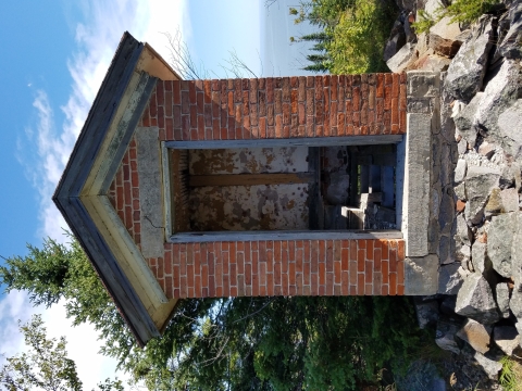
1868 - The lighthouse and outhouse are built on the highest part of the island, 163 feet above the lake to help prevent shipwrecks like the Artic and George Nester. Granite from the island was used in the construction of the lighthouse.
1881 - A pair of fog signal buildings were constructed on the eastern end of the island. They were equipped with 10 inch steam whistles, which sounded for more than 300 hours per year.
1883 - The “Rock Island Line” tramway was built to help transport supplies.
1896 - The oil house was built near the lighthouse.
Sept. 17, 1898 - Forest fires burning along the south shore of Lake Superior stranded several boats. One of the boats, “the Southwest,” a 137 foot sailing vessel lost its way in the heavy fog and smoke near Huron National Wildlife Refuge. The boat sank, but the captain and all seven crew members escaped. The captain complained that the fog signal wasn’t working, which may have been true since it was being renovated at the time.
1898-1899 - A new fog signal building was built. This replaced the two smaller fog signal buildings.
Oct. 10, 1905 - Theodore Roosevelt created the Huron Islands Reservation by signing executive order 357-D. “It is hereby ordered that the unsurveyed islands of the Huron islands group…” “… are hereby reserved and set apart for the use of the Department of Agriculture as a preserve and breeding ground for native birds. This reservation is to be known as the Huron Islands Reservation.” At that time the predecessor of the U.S. Fish and Wildlife Service was housed under the Department of Agriculture. The U.S. Fish and Wildlife Service would not be formed until 1940 when a reorganization of the government moved it to the Department of Interior.
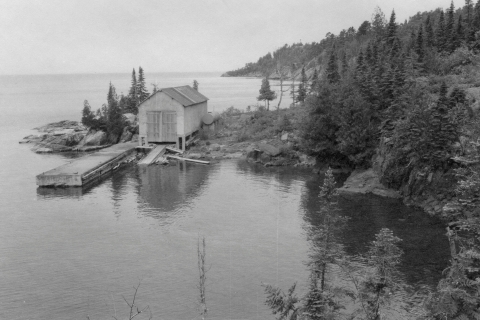
1913 - The boathouse was built.
1931 - The fog signal building was renovated and a new type of fog signal which used forced air instead of steam was installed.
1934 - The lighthouse was electrified and the keeper’s house was built next to the lighthouse.
Jan. 21, 1938 - President Franklin D. Roosevelt signed executive order 7795. This order renamed the Huron Islands Reservation to the Huron Migratory Bird Refuge. The refuge’s main purpose was to conserve migratory birds. It also moved the primary jurisdiction of 22 acres of land and secondary jurisdiction of the remaining 125 acres to the Department of Agriculture. The islands were owned by the Departments of War and Commerce.
Sept. 2, 1937 - Huron Migratory Bird Refuge was renamed to the Huron National Wildlife Refuge. The official notice is in Vol. 5 Number 147 of the Federal Register published July 30, 1940.
1950 - The U.S. Coast Guard took over the operation of the lighthouse, fog signal building and other structures from the U.S. Lighthouse Service.
1951 - The boathouse was renovated, extending its length.
1961 - The barracks were built to house five coast guard crew members after the old lighthouse keepers quarters was deemed insufficient.
Oct. 23, 1970 - The refuge was classified as a wilderness area.
1972 - The lights were automated and the fog signal was deemed unnecessary due to advances in technology.
Sept. 2, 1975 - The lighthouse is added to the National Register of Historic Places.
1978 - The majority of Lighthouse Island, 33 acres, was transferred from the U.S. Coast Guard to the U.S. Fish and Wildlife Service.
1982 - East Huron or McIntyre Island, 83 acres, was transferred from the U.S. Army of Engineers to the U.S. Fish and Wildlife Service.
Oct. 1994 - 89 miles of waters surrounding Huron National Wildlife Refuge became part of the Marquette Underwater Preserve. All three shipwrecks mentioned above are part of the preserve.
1998 - The remainder of Coast Guard lands and the Lighthouse are transferred to the U.S. Fish and Wildlife Service.
Other Facilities in this Complex
Huron National Wildlife Refuge is part of a complex of refuges. Staff at Seney National Wildlife Refuge manage the refuges in northern Michigan including Harbor Island National Wildlife Refuge. Staff share management of Michigan Islands National Wildlife Refuge with Shiawassee National Wildlife Refuge. Staff also manage the Kirtland’s Warbler Wildlife Management Area.
