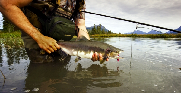
Fishing season is in accordance with state regulations. Available species include striped bass and sea-run brown trout with fly rod or other tackle. Refuge regulations require the use of non-lead jigs and sinkers.
Fishing is a traditional use of the National Wildlife Refuge System. Across the country, National Wildlife Refuges work closely with state agencies, tribes, and private partners to expand recreational fishing access. Fishing provides opportunities for communities, families, and individuals to enjoy the outdoors, support conservation efforts, and participate in a popular American tradition.
At the Rachel Carson National Wildlife Refuge, we welcome people of all backgrounds and abilities to participate in recreational fishing. Maine’s beautiful coastline is a well-known destination for anglers seeking striped bass, Atlantic mackerel and other saltwater species. All refuge waters open to fishing are tidal waters.
Learn more about Rachel Carson NWR's Fishing Plan
There are numerous locations on the refuge from which fishing activities may be accessed:
Chauncey Creek ~ Kittery
Carry-in, non-motarized boat access only at the intersection of Cutts Island and Seapoint Roads. Note that tidal changes in this area may cause previously navigable channels to become treacherous or impassable. Park adjacent to the site on Seapoint Road.
Brave Boat Tidal Creek ~ York
Fishing permitted on north side of streambank from Brave Boat Harbor Road to the first trestle downstream, approximately 1,000 feet. Park at pull-off northeast of Brave Boat Harbor Road, south of Payne Road, adjacent to creek. No refuge parking available.
Ogunquit River ~ Ogunquit/Wells
Anglers may fish on the north bank of the Ogunquit River, east of Route 1. Access is limited to the marked and posted areas at the refuge boundary corner behind the Ogunquit River Inn and Suites east (downstream), on the Wells side of the river, for approximately 500 feet. No refuge parking available.
Stevens Brook ~ Wells
The east side of Stevens Brook is open for fishing from Bourne Avenue to the point where Stevens Brook approaches Ocean Avenue (approximately 1/4 mile). Approach from the public parking lot on Ocean Avenue.
Webhannet River ~ Wells
Fishing permitted along the west bank of the Webhannet River. The area begins at the north side of Mile Road and continues approximately 400 feet north (downstream), ending at the first tidal creek.
Merriland River/Skinner Mill ~ Wells
Anglers may fish from the refuge boundary, east (downstream) for approximately 1,000 feet, which includes the oxbow. Access is by an existing trail on the south side of the river across private property. Park on Skinner Mill Road; no refuge parking available.
Mousam River ~ Kennebunk
Fishing allowed east of Route 9, on north side of river, west to our posted boundary and east to the point opposite Great Hill Road (approximately 0.3-mile). Access will be from the Bridle Path along the first tidal creek. Fishing is currently allowed on the opposite bank and at the mouth of the Mousam River. Park on Route 9; no refuge parking available. A public boat launch is also located on the northeast end of the Mousam River Bridge on Western Avenue (Route 9).
Little River ~ Biddeford
At the end of Granite Point Road in Biddeford, two shoreline sites along the Little River are open for fishing. These two areas total approximately 2,383 meters. Very limited parking is available at the end of Granite Point Road in designated spaces.
Goosefare Brook ~ Saco
Anglers may fish on the south side of the Goosefare Brook outlet. There is very little parking in the immediate area; use the public parking lot at the end of Bayview Road.
Spurwink River ~ Scarborough
Fishing is permitted along the west bank of the Spurwink River, north of the Route 77 bridge. The area extends approximately 1,000 feet, ending at a point near the fork in the river. Limited parking available just off Route 77. A carry-in, carry-out, non-motorized boat launch is also located here.

