This story is written by Lauren Cusimano, Communications Manager, Audubon Alaska, and originally appeared in On The Wire.
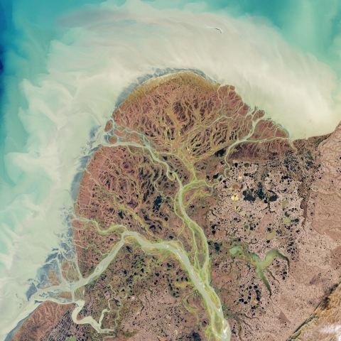
The following is not a little-known fact: Most North American birds have declined significantly since the 1970s. However, information about the size and trend of many populations, especially shorebirds, is still unknown. With that, let’s zoom in on one under-surveyed region of Alaska: the Yukon-Kuskokwim Delta (YKD).
The YKD is the ancestral land of the Yup’ik, Cup’ik, and Deg Xit’an peoples. It’s home to 50 Indigenous communities and the Yukon Delta National Wildlife Refuge. It has two globally Important Birds Areas (IBA)—the Central Yukon-Kuskokwim IBA and the Yukon River Delta IBA—and is a Western Hemisphere Shorebird Reserve Network (WHSRN) site of hemispheric importance.
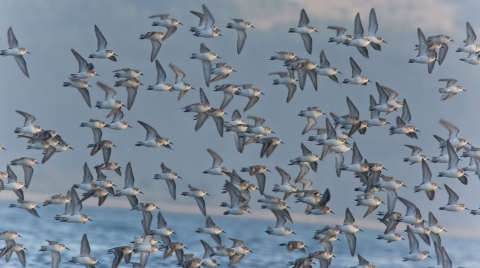
According to WHSRN, more than 500,000 shorebirds use the Refuge annually, including over 30% of the global population of Bar-tailed Godwit and Bristle-thighed Curlew. Other data, though limited, indicated that YKD had high densities of breeding shorebirds, but the area hadn’t been thoroughly surveyed. That is, until 2015 and 2016 when a team “conducted the first extensive, statistically robust surveys of breeding shorebirds across the YKD.”
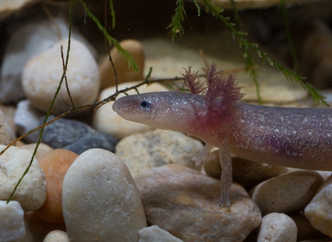
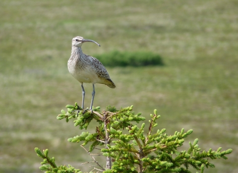
The results of those field seasons are the recent journal article “Alaska’s climate sensitive Yukon–Kuskokwim Delta supports seven million Arctic-breeding shorebirds, including the majority of six North American populations.” The paper reports the relatively undeveloped but climatically sensitive YKD is important to 21 species of shorebirds. Here you’ll find most of North America’s breeding Pacific Golden-Plovers, Black Turnstones, Western Sandpipers, Dunlin, and of course, the aforementioned Bar-tailed Godwit and subspecies of Whimbrel.
This is a big deal, though unsurprising to many who have studied or spent time in the area—who we’re going to hear from now.
About the Study Area
The Refuge covers about 19 million acres, which is approximately the size of South Carolina. The entire YKD region is roughly the size of Maine. And it’s teeming with life.
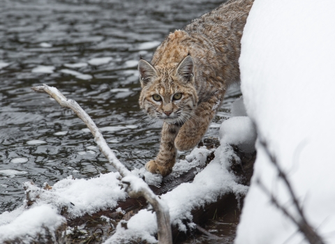
“There’s so much out there. There’s fox, beaver, there’s otter, there’s … lots of lemmings or voles,” says Brian McCaffery. There are also brown and black bears, caribou, moose, wolves, muskox, and marine mammals, including whales, among other species.
And McCaffery would know. He started as a volunteer on the YKD in 1984 (and has been conducting shorebird research since 1978). For the Refuge, he’s been a biological technician working on subsistence harvest waterfowl surveys, an outreach and education specialist, a supervisory wildlife biologist, and the acting refuge manager—among other roles. He’s also behind the only other study that provided population sizes for breeding shorebirds on the YKD. In 2012, he and colleagues investigated an 853-square-kilometer area near Hazen Bay. He says the region’s ancient volcanic areas support dense concentrations of cliff-nesting raptors, “Gyrfalcons, Golden Eagles and Rough-Legged Hawks.” There are also high densities of breeding songbirds along the river corridors. Out in the Bering Sea, there are very large and significant seabird populations of murres, puffins, and kittiwakes.

“Oh, and my colleagues will shoot me for this. I completely forgot to mention waterfowl,” he says. This is one of the premier waterfowl areas in the world, especially for large-body water birds. “So ducks, geese, swans, cranes, gulls, terns, and in really high densities.”
And finally, there are 44 species of fish (including all five species of Pacific salmon).
“There’s a ton of fish out there and a ton of people dependent on the fish out there from the coastal villages, all the way on up the riparian riparian
Definition of riparian habitat or riparian areas.
Learn more about riparian corridors of the Refuge,” he says.
For the journal article, the study area stretches beyond the Refuge a bit. It includes “most of the Yukon–Kuskokwim coastal lowlands physiographic province which was formed by the Yukon and Kuskokwim Rivers and their tributaries.” The stratum is categorized into tidal, coast, coastal plain, lowlands, uplands, riverine, and mountains. And any of these descriptors and/or formations could apply: Graminoid meadows, tidal rivers, sloughs, shallow water bodies, flat, dry, hilly, dwarf shrubs, mosses, and lichens, volcanic cinder cones, craters, and lava flows.
What we’re trying to say: The place is varied. But what does this vast corner of Southwestern Alaska feel like? What is the vibe?
Again, McCaffery can answer that. He was tasked with this assignment in the 2000s. He described the region in a passage published in "Arctic Flight Adventures Amongst Northern Birds"—a collection of sketches and paintings by James McCallum. Here’s an excerpt:
The Delta is a place of contrasts. The flashing black-and-white of a Sabine’s Gull ripples in the shimmering heat reflected from a frozen spring landscape. Massive brown rivers, the colour of well-creamed coffee, are fed by alpine streams so clear that one can see the scutellations on the legs of wading tattlers.
And since it’s summer at the time of publication, here’s another:
Here mystery, exploration and discovery are a daily part of a biologist’s life, and questions cascade endlessly like the headwaters of a river; the wild, wistful cries of loon and crane pierce the lavender stillness of summer twilight; surging pulses of salmon track obscure olfactory currents to their natal streams and brightly-clad Native women stoop over the tundra to harvest the bounty of late-summer berries.
With all that magical YKD imagery in your head, it’s a wonder a field team could get any work done. But one did.

How the Study Was Done
“I love being alone in the wilderness,” says Rick Lanctot, Alaska Regional Shorebird Coordinator with the U.S. Fish and Wildlife Service. “It’s so different than when you’re with a party of people. … It’s really exhilarating and the funnest thing I do in my job.”
Lanctot is recalling the field seasons of 2015, which was wet, and 2016, which was beautiful and clear, on the YKD.
To reach the conclusion published in “Alaska’s climate sensitive Yukon–Kuskokwim Delta supports seven million Arctic-breeding shorebirds, including the majority of six North American populations,” the team followed the Arctic Program for Regional and International Shorebird Monitoring (PRISM) approach. PRISM has been used to estimate the abundance of breeding shorebirds in northern Alaska and across Arctic Canada since its inception in 2002 by employing double sampling to estimate population size. This means that “fieldwork consisted of a combination of rapid surveys by one team (rapid surveyors) at a large sample of plots and more intensive surveys by a second team (intensive surveyors) at a subsample of those same plots,” reads the report.
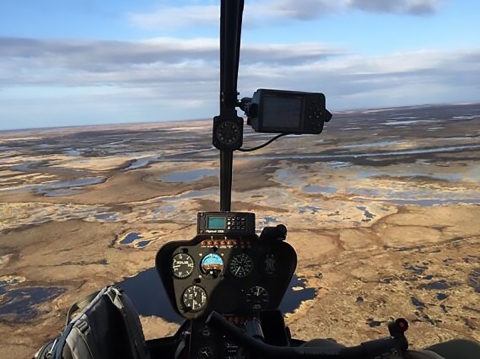
To get the plots, “You break [the YKD] into these little grids of 400-meter by 400-meter cells … you just put this big grid over your whole landscape,” says Lanctot. “And then you overlay that with the major habitat types. And from that, you randomly select plots of these little cells to survey within each of these habitat strata.”
We’ll first focus on the rapid surveys.
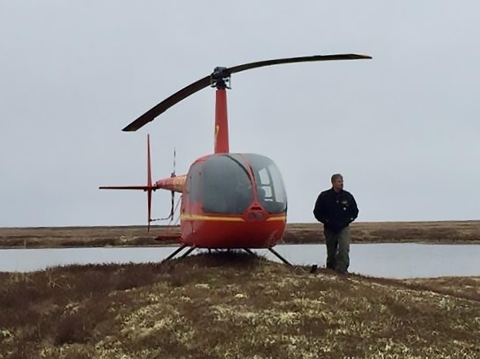
Lanctot says there’d be three people in a helicopter with a pilot. One person would be dropped at a random spot, the second person over here, a third person over there. Lone rapid surveyors would zigzag across their 16-hectare parcel, walking in W patterns to cover the full cell.
“Based on observations of birds, the behavior of the birds, and the location of the bird, you try to determine how many are breeding inside that little square,” Lanctot says. “But you only have 96 minutes.”
This occurred from May 15 to June 9, 2015, and May 15 to 25, 2016, “when shorebirds were most actively displaying as they established territories and initiated nests,” the report reads. The observer would record the location of all nests and probable nests, plus males, females, pairs, birds of unknown sex, and groups of shorebirds. And then the pilot would pick you up.
“Each person does four a day, usually,” Lanctot says. “We used to do five when we were younger.”
Intensive surveyors were treated to more of a camping trip.
“They will survey those sites very intensively for like a month,” Lanctot says. “You’ll go to each cell at least four hours a day and try to find every single bird you can that’s nesting there.”
Intensive surveys were conducted from May 14 to June 10, 2016, at Boot Lake (which was only accessible by float plane) and from May 17 to June 21, 2016, at Kanaryarmiut Field Station. The team used rope dragging to locate nests by “flushing adults from nests or following adults back to nests.” And just for good measure, the same rapid surveyors from before would go and survey these intensive sites using the 96-minute protocol.
Overall, the team conducted rapid surveys on 589 of the 223,555 plots, and intensive surveys were conducted on eight plots.
However, the work wasn’t done once the surveyors left the YKD.
One co-author is our very own River Gates, Pacific Shorebird Conservation Initiative Coordinator with Audubon. Though not in the field for this assignment, Gates worked with the team to redesign the field survey techniques, to improve the efficiency and accuracy of data collection, knowing that the surveys would be challenging due to the density of birds on the Delta.
Though we’ve already spoiled the results, here’s what they found: “The total estimated number of shorebirds in the study area, obtained by summing the taxa-specific estimates, was ~7 million individuals.” The most abundant taxa in the coastal habitats were Dunlin, Black Turnstone, Long-billed Dowitcher, Semipalmated Sandpiper, Red Phalarope, and Ruddy Turnstone. The most common species in the interior habitats were the Red-necked Phalarope, Least Sandpiper, Pacific Golden-Plover, and Whimbrel.
If you’re super interested in more information on how the authors arrived at that number, I encourage you to scroll to the “Statistical Methods” section of the journal article.
How the Study Can Be Used for Conservation
Again, the results weren’t necessarily a shock to those who have studied the area.
“We have known for a long time that the Yukon-Kuskokwim Delta hosts millions of shorebirds,” Gates says, “but this study allowed us to quantify it in a way that gave us precision for those estimates.”
McCaffery experienced a different kind of shock.
“The surprise was that that number was so close to the cocktail napkin estimates that Bob Gill and I came up with decades ago,” he says. Robert E. Gill, Jr., is a now retired research biologist with the U.S. Geological Survey and another co-author of this paper. Therefore, “Having that be the number itself doesn’t surprise us, because we’ve known for years that there’s an awful lot out there.”
So we have the magic number: 7 million breeding shorebirds. Now what?
The paper reads that these results could “contribute to refining American shorebird population estimates, determining the effects of global warming, identifying species and sites of conservation concern both on the YKD and elsewhere, and evaluating conservation success by measuring population change over time.”
So that means “the information is useful for setting global population numbers, which are used frequently to justify the protection of critically important sites for birds,” Gates says. “Conservation planning hinges on the fact that we know how many birds we have in the world and what percentage of those birds are at the different sites and which sites are important.”
McCaffery says this paper can be used for conservation planning because government agencies and conversation organizations like hard data.
“Seven million, that’s a big number, and having it be a formal estimate allows agencies to justify expending funds for learning more and monitoring … perhaps being able to do it more frequently,” he says. “For conservation agencies, they really like having a number for setting their priorities, designing their agendas, doing fundraising … policymaking.”
While this paper gives a hard number to agencies for conservation initiatives, it can also influence future management of the region when it comes to proposed anthropogenic factors like mineral extraction, any transportation or freight that could result in a spill (like fuel barging), and oil, gas, and wind development.
McCaffery says because this study broadly evaluated bird densities in different habitats and strata, it can give Refuge managers “some ammunition” if development is proposed.
“Knowing where the highest concentrations of birds are, and actually having some concrete data about that … provides some spatial context, not just numerical context,” he says, which is ideal for conserving habitats where the shorebird densities are the highest.
Why Worry About YKD Shorebirds Now?
McCaffery says that relative to other taxa, shorebird populations haven’t been a very high priority for conservation in western Alaska.
“That same area of southwestern Alaska is the homeland of the Yup’ik people,” he says. “and so the wildlife resources that they depend on, and I would say justifiably, have been the focus of concern and monitoring.” Think waterfowl, salmon, and moose. Shorebirds are not a huge part of the subsistence economy, with a few exceptions, “but they are part of what we as Americans are responsible for protecting and preserving, specifically the U.S. Fish and Wildlife Service.” This may be why this 2023-published paper provides the “first large-scale assessment of shorebird populations on a 57,259 km2 subarctic coastal delta in western Alaska.”
But the momentum has to keep rolling because, as we mentioned at the top, shorebirds are not doing so hot.
First, there’s the fact that North America has lost nearly three billion birds since 1970—or more than one in four birds. Then, the Pacific Americas Shorebird Conservation Strategy states that “Globally, 45% of Arctic shorebird populations are decreasing.” In the Pacific Americas Flyway, 11% of shorebird populations are demonstrating long-term declines, another 46% have unknown population trends, and just 43% are stable.
The Pacific Americas Shorebird Conservation Strategy also states this plain fact: “Shorebirds are especially vulnerable to environmental and anthropogenic perturbations.”
Like many areas in Alaska, the YKD is under various threats one could file under climate change climate change
Climate change includes both global warming driven by human-induced emissions of greenhouse gases and the resulting large-scale shifts in weather patterns. Though there have been previous periods of climatic change, since the mid-20th century humans have had an unprecedented impact on Earth's climate system and caused change on a global scale.
Learn more about climate change . Think habitat loss and the degradation of estuaries and delta ecosystems. This is happening because the region is climate sensitive—as is in the title—to intensifying weather events and rising sea levels. “As climate change accelerates and sea level rise continues, low-lying coastal habitats … are vulnerable to increased flooding, storm surge, salinization, and sedimentation,” it reads.
McCaffery says while he was on the Refuge, that the two most important threats were (and are) coastal flooding (meaning shoreline erosion) and thawing permafrost.
“Between flooding and permafrost melting, there have been some significant changes already and they very well may accelerate,” he says.
Southern coastlines used to be protected by ice from fairly early in the fall. And by and large, they no longer are. “The energy of those storms, at least in terms of the water, was kept offshore and wasn’t impacting the shoreline, wasn’t impacting those coastal villages,” McCaffery says. “That’s no longer the case.”
Then there’s melting permafrost, which is already having an effect. For example, permafrost creates ice wedges, which form little islands of heath where Western Sandpipers like to nest. With permafrost melting, those formations are sinking, which results in unproductive habitat for nesting birds. What’s more, permafrost is warmer to begin with on the YKD than in the geographic Arctic.
“So the tipping point is sooner on the Delta,” McCaffery says.
In the introduction, we asked you to zoom in on the Yukon-Kuskokwim Delta. Now we’re asking you to zoom back out; way out.
Because the most important conservation work we could do for Alaska shorebirds, at least in western Alaska, might not be in western Alaska. It may be along their flyways and where they winter. The vague takeaway is this: Where we can take conservation initiatives, we should.
“If we really want to protect our birds up north,” he says, “We have to make sure they’ve got places that are safe and productive.”
Because 7 million breeding shorebirds may depend on it.