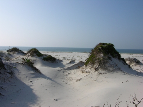
Coastal barriers, the narrow low-lying landforms located at the interface of land and sea, buffer the bays, salt marshes, and wetlands behind them that in turn support a great diversity of plants and animals, including many threatened and endangered species, and protect people and property on the mainland from the full impact of hurricane winds and storm surge. With the passage of the Coastal Barrier Resources Act (CBRA) on October 18, 1982, Congress recognized that certain actions and programs of the Federal Government have historically subsidized and encouraged development on coastal barriers coastal barriers
Learn more about coastal barrier landforms.
Learn more about coastal barriers . This has resulted in the loss of natural resources; threats to human life, health, and property; and the expenditure of millions of tax dollars each year.
CBRA does not prohibit or regulate development; rather, it removes the federal incentives to build on these unstable and environmentally sensitive areas. The purposes of the law are to save taxpayer dollars, keep people out of harm’s way, and protect important habitat for fish and wildlife. The law accomplishes this by restricting most new federal expenditures and financial assistance (including flood insurance through the National Flood Insurance Program) in areas designated within the John H. Chafee Coastal Barrier Resources System John H. Chafee Coastal Barrier Resources System
Learn more about the John H. Chafee Coastal Barrier Resources System, which was established under the Coastal Barrier Resources Act in 1982.
Learn more about John H. Chafee Coastal Barrier Resources System (CBRS). The U.S. Fish and Wildlife Service (Service) is responsible for administering CBRA, which includes maintaining and updating the official maps of the System and consulting with federal agencies that propose to spend funds within these designated areas. The CBRS now encompasses about 3.5 million acres along the Atlantic, Gulf of Mexico, Great Lakes, U.S. Virgin Islands, and Puerto Rico coasts.
Studies find that CBRA has been highly effective in achieving its objectives over the past 40 years and will serve as an important climate adaptation tool for decades to come.

CBRA Successes:
Savings to American Taxpayers: A 2019 study published in the Journal of Coastal Research analyzed the economic benefits from CBRA and found that it reduced federal coastal disaster expenditures by $9.5 billion between 1989 and 2013, and forecasts that additional savings will range between $11 and $108 billion by 2068 (in 2016 dollars). A 2024 study in Nature Climate Change found that the CBRS significantly reduces flood claims to the National Flood Insurance Program, generating an estimated savings to the Federal Government of an additional $930 million per year.
Lower Development Rates in Hazard Prone Areas: Three separate studies evaluated the effectiveness of CBRA in discouraging development on coastal barriers and found that it has been successful in decreasing development rates and densities of hazard prone coastal areas. Development rates within the CBRS are about 75-83% lower than those outside of the CBRS (Frontiers in Ecology and the Environment, 2022; Nature Climate Change, 2024). Development intensity of CBRS areas is comparable to that of protected areas such as parks (PLOS ONE, 2020). CBRA achieves this reduced development intensity through disincentives only, without the costs associated with purchasing and managing the land.
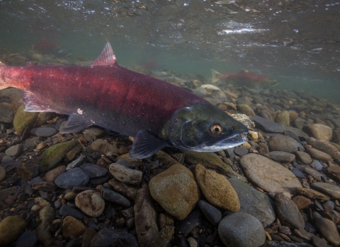
Habitat Conservation and Ecosystem Services: CBRA helps protect biologically rich coastal and estuarine habitats which support at-risk species, commercial and recreational fisheries, and tourism. These areas also serve as natural storm buffers that protect the mainland by attenuating waves and absorbing floodwaters and enhance water quality by filtering pollutants. A study published in Land Use Policy in 2021, examined how the removal of federal subsidies affected investments in coastal protection infrastructure. This study found that parcels within the CBRS have 78% lower odds of being armored with structures, such as seawalls. This results in better habitat and more resilient beaches. A 2024 study in Nature Climate Change found that CBRS areas see a 41% reduction in built-up surface area. Maintaining more porous surfaces on the landscape allows for better habitat, water filtration, and stormwater management.
Spillover Effects for Neighboring Areas: A 2024 study in Nature Climate Change found the CBRS lowered development densities by 83% but raised them by 37% in neighboring areas. This suggests the designation can be beneficial to coastal communities by reallocating growth away from the most at-risk areas while generating increased property values and tax revenues in nearby locations. This study found these spillover effects include:
- More than $900 million per year in local tax revenue increases in adjacent areas, with no evidence of a decline in local revenues within the CBRS
- Natural amenities and flood protection for areas within and adjacent to the CBRS
- 40-64% lower annual flood insurance claims (per acre) in areas adjacent to the CBRS
- Higher property sales prices and 50% higher assessed values (per acre) in areas adjacent to the CBRS
What More Can Be Done?
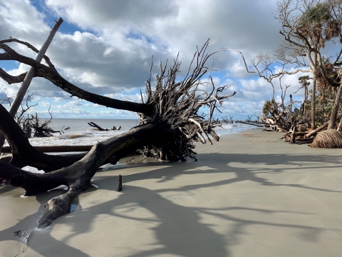
Coastal barriers are a unique and ecologically important part of the American coastline. Many of the species that utilize these areas are threatened by sea-level rise as well as habitat fragmentation caused by development. People, homes, and infrastructure on coastal barriers are also vulnerable to rising seas and more intense tropical storms. CBRA can significantly reduce development pressures within the designated areas and help local communities plan for, mitigate, and adapt to the impacts of climate change climate change
Climate change includes both global warming driven by human-induced emissions of greenhouse gases and the resulting large-scale shifts in weather patterns. Though there have been previous periods of climatic change, since the mid-20th century humans have had an unprecedented impact on Earth's climate system and caused change on a global scale.
Learn more about climate change .
Congress has directed the U.S. Fish and Wildlife Service to modernize the maps and recommend appropriate additions to the CBRS (Pub. L. 109-226). Adding areas to the CBRS will help direct new development away from risky areas that also serve as important habitat, reducing the need for subsidized federal flood insurance and future evacuations, loss of life, and costly federal disaster assistance associated with hurricanes and severe flooding events.
Additionally, states and local governments can build on these successes by raising awareness about CBRA’s limitations on federal financial assistance and layering further state and local disincentives for development within the CBRS.
Where Can I Get More Information?
To learn more about CBRA, please visit our webpage or contact us for more information.
For the methodologies, additional researching findings, and limitations of the studies referenced above, please see links to studies below.
An Analysis of Federal Expenditures Related to the Coastal Barrier Resources Act (CBRA) of 1982: https://bioone.org/journals/journal-of-coastal-research/volume-35/issue-6/JCOASTRES-D-18-00114.1/An-Analysis-of-Federal-Expenditures-Related-to-the-Coastal-Barrier/10.2112/JCOASTRES-D-18-00114.1.short
Removing development incentives in risky areas promotes climate adaptation: https://www.nature.com/articles/s41558-024-02082-3#citeas
Removing federal subsidies from high-hazard coastal areas slows development: https://esajournals.onlinelibrary.wiley.com/doi/10.1002/fee.2532
Does removal of federal subsidies discourage urban development? An evaluation of the US Coastal Barrier Resources Act: https://journals.plos.org/plosone/article?id=10.1371/journal.pone.0233888
How does the removal of federal subsidies affect investment in coastal protection infrastructure?: https://www.sciencedirect.com/science/article/abs/pii/S0264837720325837?via%3Dihub