Visit Us
Presquile National Wildlife Refuge is an island located in the James River. There are no hard-line phones or mail service on the refuge. The refuge can be visited during refuge sponsored events and by pre-arranged permit. Advanced reservations are required prior to visiting. People wishing to visit the island by permit are to make a request by contacting the refuge office location at least three business days prior to the proposed date of visit. In most cases, boat transportation and launch locations are to be secured by the permittee. The refuge does not have a mainland launching facility or provide access other than during special events. When visiting please be mindful of the elements. Dress appropriately for the weather and bring sufficient water.
Activities
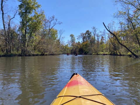
Once on the island, three miles of trails and boardwalks offer access to excellent wildlife viewing. The Menenak Discovery Center houses interpretive displays and conservation materials intended to inspire visitors. Canoe/kayak water trails and launch site facilitate on-island experiences for students of the James River Ecology School. Rich cultural history is represented with ties to early expeditions of John Smith, former farm structures, and an 18th century cemetery.
Trails
Please remember a special use permit is required to access the property. Refuge trails, boardwalks, and kiosks provide family-friendly wildlife viewing areas. The refuge has few hills, so all trails have very little elevation-gain, offering easy walks without losing any of the nature-experience opportunities. Need help navigating? Print your own trail map or pick up one of the yellow trail description brochures when you arrive on the refuge.
Turkey Island Creek Trail
Open: Year Round except during times of conflicting refuge-sponsored programs (I.e. James River Ecology School programs, hunt program, etc.)
Length: 3 miles
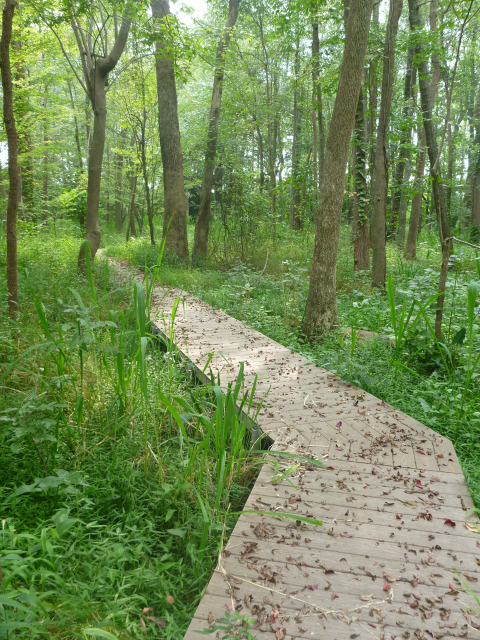
The start of Turkey Island Creek Trail begins at the western boat dock. The meandering grass trail forms the shape of the number ‘8’ with a few finger trails. The passageway extends, via boardwalk into the flooded forests of the island. The boardwalk terminates at the canoe launch along the southern interior creek. Much of the trail is in upland habitat, either successional or mature forest. A portion of the trail skirts a large field maintained for pollinator habitat. The trail is adjacent to the Menenak Discovery Center (MDC), which has interpretive signs, classroom and restrooms. Also available at the MDC is information about the refuge and trail map brochures. A variety of wildlife can be seen from the trail, depending on the time of day and season of your trip. Eagles, osprey, deer, turkey, and turtles are all common sightings.
Related Documents
Other Facilities in the Complex
Presquile National Wildlife Refuge is managed as a part of the Eastern Virginia Rivers National Wildlife Refuge Complex, which is comprised of four different refuges. Please click the links below to learn more about these refuges.
Rules and Policies
Access to the island is to occur in concert with refuge sponsored public events or by Special Use Permit
Only authorized wildlife dependent recreation activities may occur. These include: wildlife observation, nature photography, environmental education, and interpretation.
Visitors must stay on designated trails. Pets are prohibited from entering the refuge.
Ensure resources are not impacted from your visit. Avoid disturbance to animals, plants, and natural history items. Collecting and removing any of these items is prohibited.
Searching for and/or collecting artifacts whether on the surface or subsurface (digging) is strictly prohibited. Stiff penalties, even imprisonment, can result from such action.
Locations
Directions to the Administrative Office: Turn North onto Kimages Road (Route 658) from John Tyler Memorial Highway (Route 5). Proceed approximately 1 mile and turn right into the Harrison Lake National Fish Hatchery Campus. The refuge office is located in the fourth brick building.
Directions to the Refuge: Presquile NWR is located near Hopewell, Virginia, in Chesterfield County, and is approximately 20 miles southeast of Richmond, the State capital. Please note the refuge is an island and only accessible by special use permit or during refuge sponsored events. The regional context of the project area is defined by the interactions of the nearby metropolitan area, the James River watershed, and the Chesapeake Bay Estuary.


