From spring 1804 to fall 1805 — at the direction of President Thomas Jefferson — Meriwether Lewis, William Clark and about three dozen other people traveled from the Midwest to the Pacific Ocean.
Commonly known as the Lewis and Clark Expedition, the group called itself the Corps of Discovery. The corps included a woman (Sacagawea), her baby boy (Jean Baptiste) and enslaved man (York).
In search of a water route to the Pacific, the explorers opened a window into the West by documenting plants, animals, birds, weather, physical geography and other natural phenomena along the way.
Today, the National Park Service’s Lewis and Clark National Historic Trail covers about 3,700 miles in 11 states and many tribal lands from Wood River, Illinois, to Astoria, Oregon.
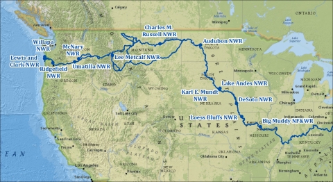
A couple dozen U.S. Fish and Wildlife Service national wildlife refuges are situated roughly along the explorers’ westbound route. This story features a dozen refuges, in east-to-west order.
Because rivers have meandered or been dammed and channelized since the early 1800s, the scene today is not precisely what the explorers saw. But refuge terrain along the trail today embodies the natural landscape they encountered.
Big Muddy National Fish and Wildlife Refuge
In May-June 1804, the Lewis and Clark Expedition followed the Missouri River across the river’s namesake state just as Big Muddy National Fish and Wildlife Refuge does now.
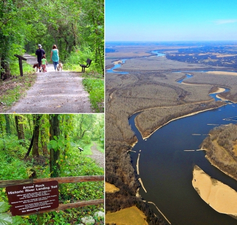
Today, a great place to connect with the expedition is on the Lewis and Clark Trail of Discovery at the refuge’s Jameson Island Unit. Near the historic village of Arrow Rock, the one-mile interpretive trail leads from a parking area to the banks of the Missouri River. A walk along the trail is “representative of what the historic river and floodplain habitat may have looked like during the Corps of Discovery journey,” says refuge visitor services manager Tim Haller.
Loess Bluffs National Wildlife Refuge
In early July 1804, the westbound expedition camped for two nights near what is now Loess Bluffs National Wildlife Refuge, about 90 miles north of Kansas City. Clark noted in his journal that the prairies along the Missouri River were beautiful and that “the lands are low Subject to overflow.”
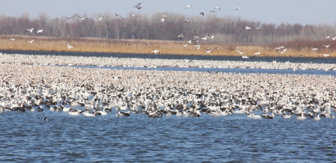
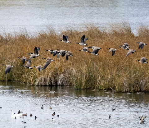
Today, the refuge’s wetlands attract millions of snow geese (see photo above) during spring and fall migration. More than 300 bird species have been documented at the refuge, including those seen by Lewis and Clark, such as American white pelicans, common egrets, American bitterns, Canada geese and wood ducks. Each year, the refuge celebrates the arrival of migrating bald eagles with Eagle Days on the first full weekend of December. A 10-mile auto tour loop allows visitors to see wildlife in a natural setting year-round.
DeSoto National Wildlife Refuge
In August 1804, after meeting with Otoe and Missouri tribespeople, the expedition camped near what is now DeSoto National Wildlife Refuge, about 35 miles north of Omaha, Nebraska.
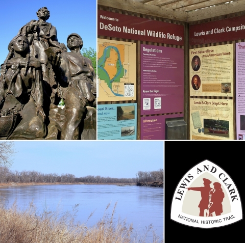
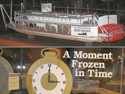
Today, refuge displays emphasize how much Missouri River habitat has changed since the time of Lewis and Clark and how that has affected native wildlife. However, the most remarkable historic feature at DeSoto Refuge is the Steamboat Bertrand Museum. The museum, in the refuge visitor center, includes 250,000 Civil War-era artifacts from the Bertrand, which sank in the river in 1865. It was discovered buried on the refuge in 1968 with most of its cargo intact. Video.
Lake Andes and Karl E. Mundt National Wildlife Refuges
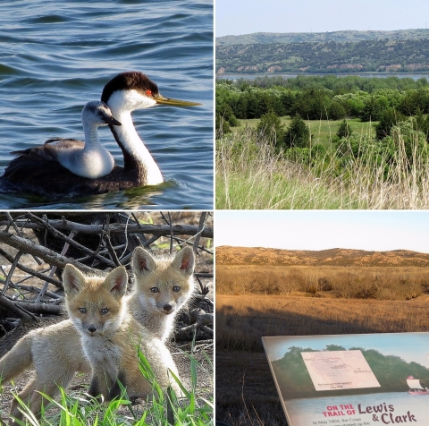
In September 1804, the expedition camped near what are now Lake Andes and Karl E. Mundt National Wildlife Refuges. In their journals, the explorers said they encountered bison, wolves and black-tailed prairie dogs.
Today, at Lake Andes Refuge you might see western grebes (top left in photo above), red fox kits (bottom left), migratory birds or waterfowl as well as other wildlife seen by the explorers. Karl E. Mundt Refuge is closed to the public to protect important habitat for up to 300 bald eagles, but a refuge overlook (right photos above) on the west bank of the Missouri River offers excellent viewing of the eagles in their natural territory.
Audubon National Wildlife Refuge
In April 1805, after overwintering at Fort Mandan, about 25 miles to the south, the expedition traveled along the Missouri River past what is now Audubon National Wildlife Refuge.
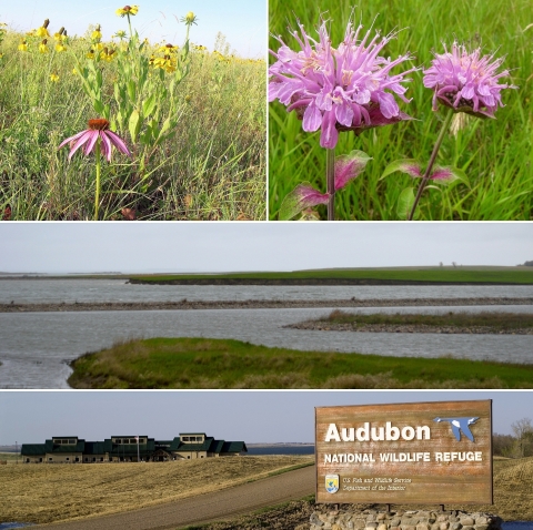
Today, the Lewis and Clark National Historic Trail on U.S. Route 83 skirts Audubon Refuge’s west boundary about a mile from the visitor center. In summer, native prairie wildflowers and grasses are on full display at the refuge. In winter, ice fishing is popular. During spring and fall, thousands of migrating birds of all types and sizes are the draw. You’re likely to see songbirds, ducks, geese, swans, pelicans, sandhill cranes and shorebirds.
Charles M. Russell National Wildlife Refuge
In May 1805, members of the expedition camped at some 20 sites within what is now Charles M. Russell National Wildlife Refuge. Many of the sites are under water today because the Missouri River was dammed to form Fort Peck Reservoir in the 1930s.
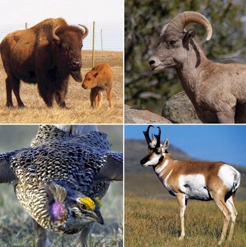
Today, one place to connect with Lewis and Clark is near the Fort Peck Interpretive Center. The center is open from mid-April to November – and, by appointment, from December to mid-April. Hours vary. Nearby overlooks at Fort Peck Dam and Milk River offer breathtaking views and include displays about the expedition. Elsewhere at the refuge you might see bison, bighorn sheep, pronghorn and sharp-tailed grouse. More than 50 fish species inhabit Fort Peck Reservoir, including walleye, northern pike, small-mouth bass, lake trout and Chinook salmon.
Lee Metcalf National Wildlife Refuge
In August-September 1805, the expedition passed through Montana’s Bitterroot Valley near what is now Lee Metcalf National Wildlife Refuge. Travelers’ Rest State Park, about 20 miles north of the refuge, was the explorers’ last stop before they crossed the formidable Bitterroot Mountains into Idaho.
Today, the expedition is celebrated when school groups visit. Typically, before nature hikes begin, one student is designated as Lewis and another as Clark, and those students lead the walks. Then, just as President Jefferson instructed the explorers, a refuge ranger instructs all of the students to record nature observations, sounds, smells and discoveries (with staff assistance) in their journals as they mimic the footsteps of Lewis and Clark. The refuge, about 25 miles south of Missoula, supports a wide range of fish, wildlife and plants.
McNary National Wildlife Refuge
In mid-October 1805, the expedition reached the confluence of the Snake and Columbia Rivers and camped near what is now McNary National Wildlife Refuge.
Today, from wildlife observation and photography to hiking, boating, fishing and hunting, there is a lot to see and do at McNary Refuge. The refuge supports migratory waterfowl, shorebirds, songbirds, raptors and various mammal, reptile and amphibian species.
Umatilla National Wildlife Refuge
On October 19, 1805, the explorers camped along the Columbia River at what is now Umatilla National Wildlife Refuge.
Today at the refuge, you can fish and hunt in season and hike or enjoy the three-mile auto tour route year-round. On a nature walk or drive in spring, you might see colorful wildflowers and an influx of birds. In summer, if you enjoy extreme heat and are prepared for it, you might see waterfowl at dawn, osprey during the day or mule deer fawns at dusk. In fall, colorful songbirds and plentiful waterfowl migrate through. And in winter, you’re likely to see bald eagles and tundra swans. The auto tour route meets the Columbia River Heritage Trail, which commemorates Lewis and Clark.
Ridgefield National Wildlife Refuge
In November 1805, William Clark described happening upon the large Native American village of Cathlapotle, at what is now Ridgefield National Wildlife Refuge. “Seven canoes of Indians came out from this large village to view and trade with us,” he reported.
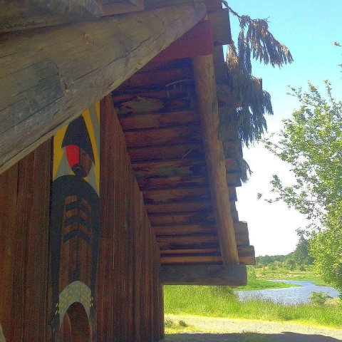
Today, following 1994 research of the archaeological site, the refuge is home to a full-scale plankhouse representative of those found at Cathlapotle. Just 25 miles from downtown Portland, Oregon, the plankhouse offers an opportunity for visitors to learn about Indigenous lifeways, human-ecosystem connection and the importance of local lands and waters since time immemorial. The refuge also offers an auto tour route and walking trails where visitors can experience wildlife, wetlands and oak forests along the Columbia River.
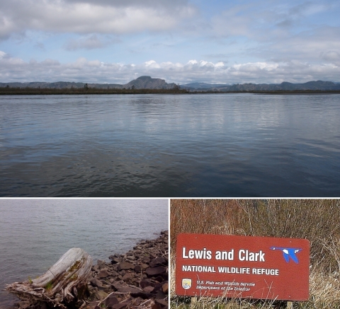
Lewis and Clark National Wildlife Refuge
In November 1805, William Clark make an exuberant entry in his journal from a point near what is now Lewis and Clark National Wildlife Refuge. Believing he had finally spotted the Pacific, he wrote: “Ocian in View! O the joy.” In reality, the explorers were seeing only the widening estuary of the Columbia River. The Pacific was still about 40 miles downriver.
Today, the expedition’s namesake refuge is 33,000 acres of islands, sand bars, mud flats and tidal marshes stretching along 27 miles of the river. The refuge provides habitat for a variety of fish. Each February and March, thousands of migrating tundra swans, Canada geese and ducks make a stop at the refuge. Accessible only by boat, the refuge offers hunting in accordance with state regulations.
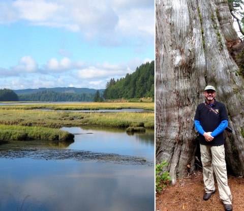
Willapa National Wildlife Refuge
In November 1805, near what is now Willapa National Wildlife Refuge the explorers reached the end of their westward journey and took a vote to determine where to spend the winter of 1805-1806. Notably, the votes of Sacagawea (a woman) and York (an enslaved man) carried the same weight as those of the other men. The group decided to camp all winter on the south side of the Columbia River at Fort Clatsop. In late March 1806, the explorers began their eastward journey back to St. Louis, where they arrived in September 1806. The round trip totaled two years, four months and 10 days.
Today at the refuge you can enjoy a range of hikes along easy-to-moderately difficult trails through verdant coastal woodlands, wetlands and old-growth forest. The refuge visitor center is about 10 miles north of where Lewis and Clark plied the Columbia River.


