
Written By

Regardless of where we come from, what we look like, or what our abilities are, we are all wild at heart. Rediscover your true nature at a national wildlife refuge national wildlife refuge
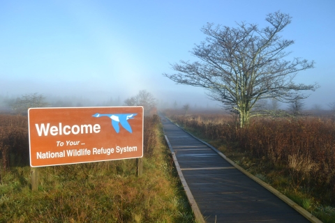
A national wildlife refuge is typically a contiguous area of land and water managed by the U.S. Fish and Wildlife Service for the conservation and, where appropriate, restoration of fish, wildlife and plant resources and their habitats for the benefit of present and future generations of Americans.
Learn more about national wildlife refuge near you. To help you plan ahead, we’ve created a comprehensive lists of the many wheelchair-accessible trails and auto tours available at our refuges from Maine to Virginia.
Maine
Aroostook National Wildlife Refuge:
Auto Tour Loop: 3 miles, paved
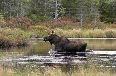
The auto tour loop allows visitors to witness the beauty of northern Maine without leaving their vehicles. Common wildlife spotted at this refuge includes moose, white-tailed deer, lynx, river otter, mink, American woodcock, bald eagles, and neotropical migratory songbirds. The auto tour loop ends at the historic Loring Air Force base that was once a weapons storage site.
Umbagog National Wildlife Refuge:
Magalloway River Trail: 0.3 mile, packed gravel
This trail takes you along the forested edge of the Magalloway River. Take in the waterside views. This pathway will lead you to an observation platform overlooking the backwaters of the river. The platform is a memorial to the late Warren E. Pearson, who helped restore and run the local Balsams Grand Resort Hotel.
Moosehorn National Wildlife Refuge:
Woodcock Trail: 0.25 mile, paved
With a fitting name, the Woodcock Trail is one of the best spots at the refuge to spot an American woodcock. If you arrive in April or May, you may just catch a glimpse of the courtship flights these birds are known for.
Observation platform, blind, and fishing pier
Moosehorn National Wildlife Refuge has received national attention for the impressive number of bald eagle chicks that hatch here each year. To catch a glimpse of our national bird, check out the accessible observation platform (with parking) off Route 1. For more discreet wildlife observation, visit the accessible blind and fishing pier on Charlotte Road between the refuge headquarters and Route 1.
Maine Coastal Islands National Wildlife Refuge:
Corea Heath Trail: 0.4 mile, packed gravel
This trail leads to an observation platform offering rare views of the plateau bog also known as a heath. This raised coastal peatland is protected habitat for several populations of rare plants.
Rachel Carson National Wildlife Refuge:
Bridle Path Trail: 3.1 miles, packed gravel
The majority of this trail is accessible, though some sections are subject to high tides and may become difficult to navigate. The trail meanders along the Mousam River and offers views of essential estuary habitat.
Massachusetts
Silvio O. Conte National Fish and Wildlife Refuge Fort River Division:
Fort River Trail: 1 mile, packed gravel and boardwalk
Tucked away in rural Western Massachusetts,this trail offers views of just about every local habitat. Stop at frequent observation platforms for a glimpse of the mountain peaks, grassland habitat, and vernal pools that make this refuge unique. Read along as you go. Each month, refuge staff places a different storybook into weatherproof cases along the trail. Parking leads directly to a pavilion at the trailhead with a nearby, accessible portable toilet.
Great Meadows National Wildlife Refuge:
Red Maple Trail: 0.3 mile,stonedust
The Red Maple Trail loops around a pond that was originally developed as a swimming hole. It is now home to a diverse population of aquatic and semi-aquatic wildlife, including fish, green frogs, and painted turtles. The end of the trail leads to an observation deck with a view of the river and floodplain.
Parker River National Wildlife Refuge:
Hellcat Interpretive Trail: 1.3 miles, boardwalk
Recently redone and entirely wheelchair-accessible the Hellcat Trail takes visitors through freshwater marsh, shrub, vernal pool, dune, and maritime woodland habitats. Be sure to check in at the interpretive panels along the way to learn more about the wildlife that flourishes here.
New Hampshire
Silvio O. Conte National Fish and Wildlife Refuge Pondicherry Division:
Mud Pond Trail: 0.6 mile, packed gravel
Due to its popularity, Mud Pond Trail has been named one a National Recreation Trail National Recreation Trail
A National Recreation Trail is a land-based or water-based trail that provides an outdoor recreation opportunity on federal, state, tribal or local public land. National Recreation Trails were established by the National Trails System Act of 1968 (Public Law 90-543), which authorized creation of a national trails system composed of National Recreation Trails, National Scenic Trails and National Historic Trails. Whereas National Scenic Trails and National Historic Trails may be designated only by an act of Congress, National Recreation Trails may be designated by the Secretary of the Interior or the Secretary of Agriculture to recognize exemplary trails of local and regional significance.
Learn more about National Recreation Trail . Expect to see a variety of bird species while enjoying the views from this path. In 2004, the Pondicherry area was designated the first Important Bird Area in New Hampshire for its rich diversity of breeding and migrating birds.
Great Bay National Wildlife Refuge:
Peverly Pond Trail: 0.4 mile loop, boardwalk and packed gravel
Enjoy glimpses of the Peverly Pond and all the wildlife it supports. This trail is perfect for viewing vernal pools that are hotspots for wildlife, especially in the springtime. In the warmer seasons, you are almost guaranteed to see painted turtles sunbathing on the banks of the pond.
Vermont:
Silvio O. Conte National Fish and Wildlife Refuge Nulhegan Basin Division:
Mollie Beattie Bog: 200 feet, boardwalk and packed gravel
The boardwalk portion of this trail takes you through a black spruce woodland bog. It is considered a state significant site and contains the largest population of rare bog sedge in Vermont.
Lewis Pond Boardwalk: 275 feet, boardwalk
This elevated boardwalk is over five feet wide, leaving ample space to maneuver. This trail is well worth the 35 minute drive to get there. With a large obervation platform overlooking Lewis Pond and Gore Mountain you're going to want to grab a camera!
Lewis Pond Overlook: Overlook, packed gravel
The Lewis Pond Overlook provides a panoramic view of the Nulhegan Basin. The overlook has a small, fully accessible parking area and short stone dust trail leading to an observation area.
Nulhegan Basin Overlook: overlook, packed gravel
This fully accessible overlook is located next to visitor contact station parking lot. Follow the short stone dust trail to panoramic views.
Black Branch Boardwalk: 250 feet, boardwalk-
Follow this elevated boardwalk as it meanders through the softwood forest. This trail ends in an observation platform overlooking the Black Branch of the Nulhegan River.
Yellow Branch Boardwalk: 150 feet, boardwalk
Accessed from Lewis Pond Road, this boardwalk leads wo an elevated viewing platform overlooking the Yellow Branch of the Nulhegan River as well as a beaver wetland teaming with wildlife.
Stone Dam Observation Platform: overlook,
This stunning overlook is only five minutes down the road from the refuge visitor center. This historical site was once used as a sluice dam that would control the flow of logs down the Nulhegan River. Historically, the Nulhegan River was used by the Nulhegan Band of the Abenaki as a transportation corridor.
Delaware
Bombay Hook National Wildlife Refuge:
Boardwalk Trail: 0.5 mile, boardwalk
The woods that begin this boardwalk trail are perfect for spotting migratory songbirds in the spring and fall. The trail ends with a view of the tidal salt marsh salt marsh
Salt marshes are found in tidal areas near the coast, where freshwater mixes with saltwater.
Learn more about salt marsh and Raymond Gut. Be sure to look for fiddler crabs along the banks.
Bear Swamp Trail: 0.25 mile, packed gravel
This trail leads to a 30-foot observation tower and a floating dock overlooking a 240-acre freshwater impoundment. This habitat is a magnet for tall wading birds in the summer. For more information on the trail, check out the trail guide that will give you stop-by-stop wildlife facts along the route.
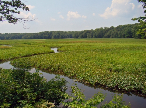
Prime Hook National Wildlife Refuge:
Dike Trail: 0.5 mile, boardwalk
This short trail will lead you to a viewing deck with expansive views of the marsh that precedes the Delaware Bay. Here, you are likely to spot red-tailed and marsh hawks, along with the shorebirds and songbirds that use the marsh as nesting habitat. The diversity of wildlife depends on the season.
Boardwalk Trail: 0.5 mile, boardwalk
The Boardwalk Trail guides visitors through uplands, forested wetlands, and over 600 feet of freshwater marsh. From this trail, you can catch glimpses of the 308 species of birds, 51 species of fish, 45 species of reptiles and amphibians, 37 species of mammals, and the array of rare insects and plant species that inhabit Prime Hook National Wildlife Refuge. Be sure to bring a camera; these views are worth documenting.
Maryland
Eastern Neck National Wildlife Refuge:
Tubby Cove Boardwalk: 0.25 mile, boardwalk
Enjoy views of the marsh and the wildlife it supports as you make your way to a wooded island. Along the way, you can enjoy two viewing platforms. Eventually, this trail leads to an accessible viewing blind. Stop by the blind to discretely observe wildlife.
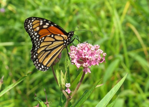
Bayview Butterfly Trail: 0.4 mile, packed gravel
With parking nearby, this convenient trail is the perfect introduction to the refuge. Along the way, stop by the deck overlooking Chesapeake Bay. Take a peek through the free binoculars for views of the Chesapeake Bay Bridge and the Key Bridge in Baltimore. Nearer to the shore, you will see the distinct stone “breakwaters” that prevent shoreline erosion as waves from the bay crash upon them.
Tidal Marsh Overlook Trail: 0.2 mile, boardwalk
What this trail lacks in length it makes up for in convenience. Located directly behind the headquarters/visitor center, the pathway winds through a native meadow leading to a photo blind overlooking the Chester River.
Tram Tour
Tickets are free for this all-electric, open-air tram tour. The tour can accommodate groups of 12 or fewer. Trips are seasonal and weather-dependent, view the website for more details.
The Loop Trail: 0.3 mile, paved
Aptly named, this short loop leaves directly from the visitor center, where you can find parking and public restrooms. From the trail, you can catch views of the Redington Lake and Ceash Lake. Along the way, you will see examples of meadow and wetland management.
New Jersey
Cape May National Wildlife Refuge:
Dune Trail: 1.8 miles round trip, boardwalk
There are two access points to this trail at the Two Mile Beach Unit. One is off of Loran Drive across from the first parking lot on the right. The other branches from the second parking lot on the left and has accessible parking next to the boardwalk. From the second access point, you can quickly reach an observation platform overlooking the beachfront. The trail winds behind beach dunes to rare maritime forest habitat.
Marsh Trail: 500 feet, boardwalk
This boardwalk trail leads to another observation platform, this time overlooking the biologically abundant salt marshes. Here you can see wading birds like herons and egrets. Listen closely and you may hear the tell-tale clacking of a clapper rail. The refuge intends to eventually expand this trail to include more than 1,500 feet of boardwalk.
Great Swamp National Wildlife Refuge:
Wildlife Tour Route: 2 miles
Open 7 days a week, this auto tour takes visitors through the marshes, grasslands, and nearby ponds that make up Great Swamp National Wildlife Refuge. Keep your eyes and ears open near the grasslands, and you may see or hear local birds of prey, including hawks and owls. Songbirds like the eastern bluebird use these grasslands for nesting. In 1976, only three nesting pairs of bluebirds were reported on the refuge. Today, with 136 nest boxes, the refuge supports one of the largest breeding populations of bluebirds in New Jersey.
Wallkill River National Wildlife Refuge:
NEW at Owen Station Crossing: More than 2 miles, packed gravel
To improve accessibility for all refuge visitors, Wallkill River National Wildlife Refuge has recently resurfaced more than two miles of trail at the Owens Station Crossing. The trail extends north and south from the visitor hub and features an accessible dock for fishing and launching kayaks and canoes. Additionally, the trailhead includes a pavilion with picnic tables, a public restroom, ample parking, and a beautiful pollinator garden.
New York
Iroquois National Wildlife Refuge:
Headquarters Trail: 1 mile, packed gravel
Start your trip at the visitor center off of Casey Road, where you’ll find parking and public restrooms. This trail will take you through flowering grasslands filled with pollinators, including many species of butterfly. As you continue along the trail, you will see a variety of habitat, including woodlands and a nearby pond. Keep an eye out for purple martins flitting through the trees, opossums in the woodlands, and wood ducks on the pond.
Wildlife Drive: 3.5 miles
This auto route is open each year from April until the first snow makes conditions unfavorable. Along the way, you will see waterfowl, marsh birds, bald eagles, osprey, harriers, and shorebirds. Keep an eye out for sandhill cranes. These large birds have an impressive wingspan, long black legs, and relatively short bills. Roll down your windows and listen for their vocalizations including a single, loud warning call, a soft call to maintain contact while foraging, and the synchronized calls of breeding pairs. There are two known nesting pairs that breed at Montezuma the refuge, although they eventually migrate south when winter weather rolls in.
Virginia
Chincoteague National Wildlife Refuge:

Wildlife Loop: 3.25 miles, paved loop
This trail offers frequent benches for resting and overlooks for wildlife viewing. Vehicles can drive the loop any day from 3 p.m. to dusk. You’ll see plenty of wading and shorebirds in the mudflats, as well as waterfowl in the shallow waters.
Swan Cove Trail: 1 mile, paved
Branching off the Wildlife Loop, this trail is one of the refuge’s most popular routes to the beach. The trail is bordered by shrub and thicket habitat. Here you may see many different species of pollinators. If you’re lucky, you may even spot the occasional muskrat or otter.
Black Duck Trail: 1 mile, paved
Also branching from the Wildlife Loop, this trail is a great place to look for turtles and songbirds.
Woodland Trail: 1.6 miles round trip, paved
Branching from the Black Duck Trail, this pathway leads you through the beautiful pine forest to an overlook where you can sometimes catch a glimpse of the famous Chincoteague ponies. As you travel along the trail, keep an eye out for the flashing silver fur of the Delmarva fox squirrel. This formerly endangered species was officially delisted as of December 2015 as a result of decades of conservation work performed by refuge biologists, state agencies, and recovery partners.
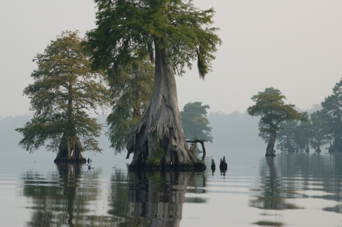
Great Dismal Swamp National Wildlife Refuge:
Lake Drummond Auto Tour: 6 miles
This auto tour will take you through the stunning wetlands that gave Great Dismal Swamp National Wildlife Refuge its name. See the impressive cyprus marsh as you make your way towards stunning Lake Drummond. There is an accessible pier at the end of this tour offering uncontested views of the lake. The gate is open 7 days a week. Permit and fee are required.
Occoquan Bay National Wildlife Refuge:
Wildlife Drive Auto Tour: 2 miles, one way
As you drive along, you will see expansive views of the wetland habitat that covers 50 percent of the refuge and includes wet meadows, bottomland hardwoods, open freshwater marsh, and tidal marshes and streams. Keep your eyes to the sky. Osprey are one of the most common bird species seen at Occoquan Bay National Wildlife Refuge. You’re likely to spot these huge birds of prey during the spring and summer.
Elizabeth Hartwell Mason Neck:
The Joseph V. Gartlan Great Marsh Trail: 0.75 mile, paved
Follow this trail through the forested peninsula to anobservation platform overlooking the Great Marsh. The platform features an accessible telescope and information panels describing typical plants and wildlife found along the trail.
West Virginia
Canaan Valley National Wildlife Refuge:
Freeland Trail: 0.4 mile, boardwalk
Freeland Trail is the refuge’s most popular trail. Recently resurfaced and expanded, this boardwalk offers all new views of shrubland, balsam fir forest, and a beaver pond. Be sure to check out the bubbling limestone spring. Parking is available at the trailhead, and restrooms are located at the refuge’s brand new visitor center.
Ohio River Islands National Wildlife Refuge:
Auto Tour: 1.5 miles
This tour runs along the western side of Middle Island and offers views of wildlife along the Ohio River. Be sure to stop at the many informational panels along the way.
Birds and Butterflies Trail: 0.1 mile, paved
Adjacent to the visitor center, this short trail is a great place to find all kinds of pollinators, including monarch butterflies. Bicycle racks, parking, and restrooms can be found next door at the visitor center.


